ESCONDIDO CANYON HIKE DISTANCE: 3.8 Miles Roundtrip (Lower Falls)
|
TRAIL HIGHLIGHTS |
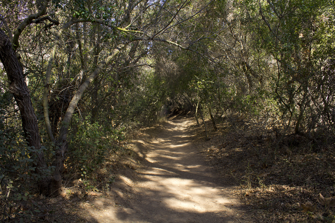
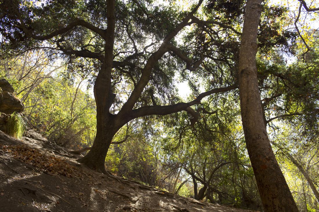
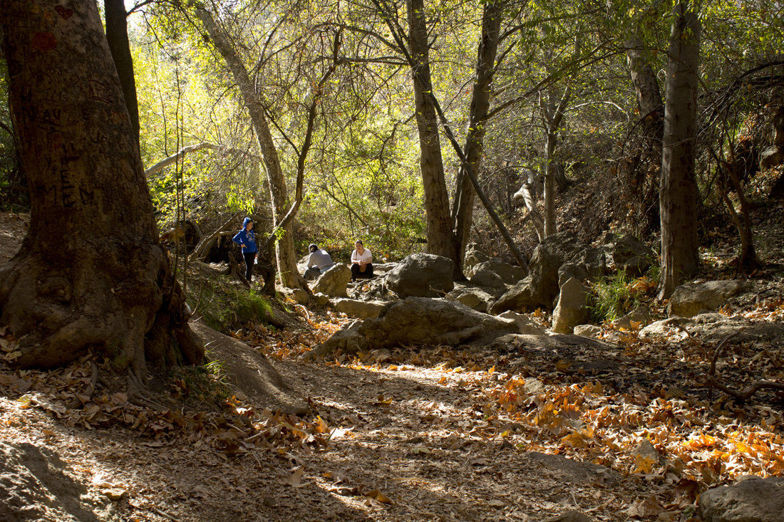
Escondido Canyon offers a gentle path through a riparian landscape of large oak trees and coastal sage scrub to a pair of seasonal waterfalls. The trail crosses Escondido Creek at several points, but unless there has been heavy rains, those crossings are generally dry. The trail begins a short distance from the Pacific Ocean and climbs moderately through a residential equestrian neighborhood before descending into the canyon itself. Once in the canyon the trail is fairly level, making this an easy hike. The lower falls grotto is a lovely shaded spot with a fairy-tale like quality even when the water isn't flowing. A scramble to the upper falls has its own rewards as you wander through the dry creek bed to the tall rocky cliff with moss hanging like stalactites from the cascade's multiple tiers. When the water flows, the upper falls are one of the finest waterfalls in southern California, but a hike through the close, tunnel-like underbrush of Escondido Canyon is always an adventure no matter what time of year you go.
|
Click the full frame icon in the upper right corner for a larger map in a separate window.
|
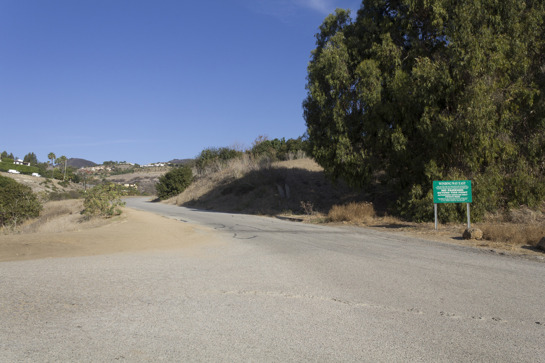
Directions to Trailhead27807 Pacific Coast Highway
Malibu, CA 90265 Take the Pacific Coast Highway (CA SR 1) to Winding Way in Malibu, CA. As you turn onto Winding Way, you will make an immediate left turn into a small parking area for the trailhead. The lot is quite small and fills up quickly even in the off season. If the lot is full, park along the Pacific Coast Highway and walk back to the parking lot. DO NOT park on the side streets or on Winding Way. These are private roads and you will be towed and ticketed. Porta-potties are located in the northeast corner of the lot. Water is not available on the hike, so bring plenty with you. The trailhead is located at the northeast corner of the lot on Winding Way. Winding Way is a private road, so walk on the dirt path at the side of the road. |
Escondido Canyon Trail Guide
Parking
Park in the small lot just off the Pacific Coast Highway on Winding Way. The lot is small and fills up quickly. Do not park on the side streets. You will be towed and ticketed. If the lot is full, park on the Pacific Coast Highway. 
Rest Rooms
Porta-Potties are available at the northeast corner of the parking area. There is no water available at the trailhead or on the hike. Bring plenty with you. 
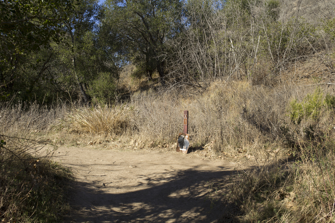
Trailhead
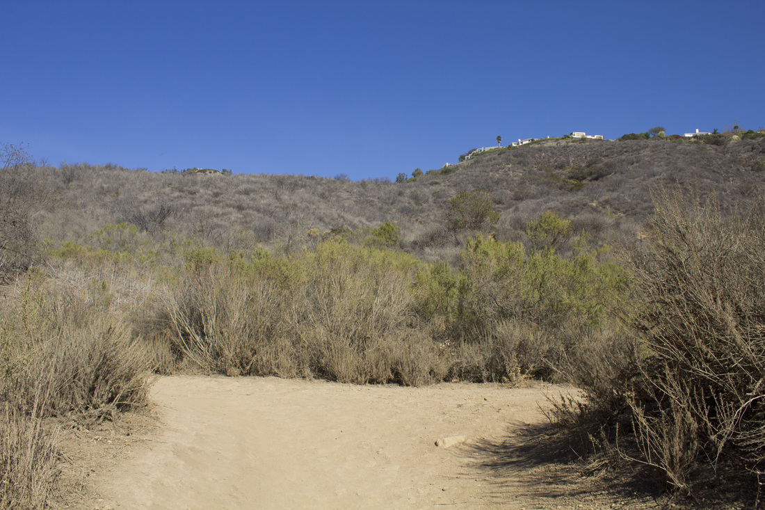
The trail begins on Winding Way at the northeast corner of the parking lot. Winding Way is a private road and passes through a residential neighborhood. You are required to walk on the footpath on the side of the road. Proceed north, following Winding Way for .8 mile to the first Trail Junction. You will gain approximately 160' on this section. 
Information Board
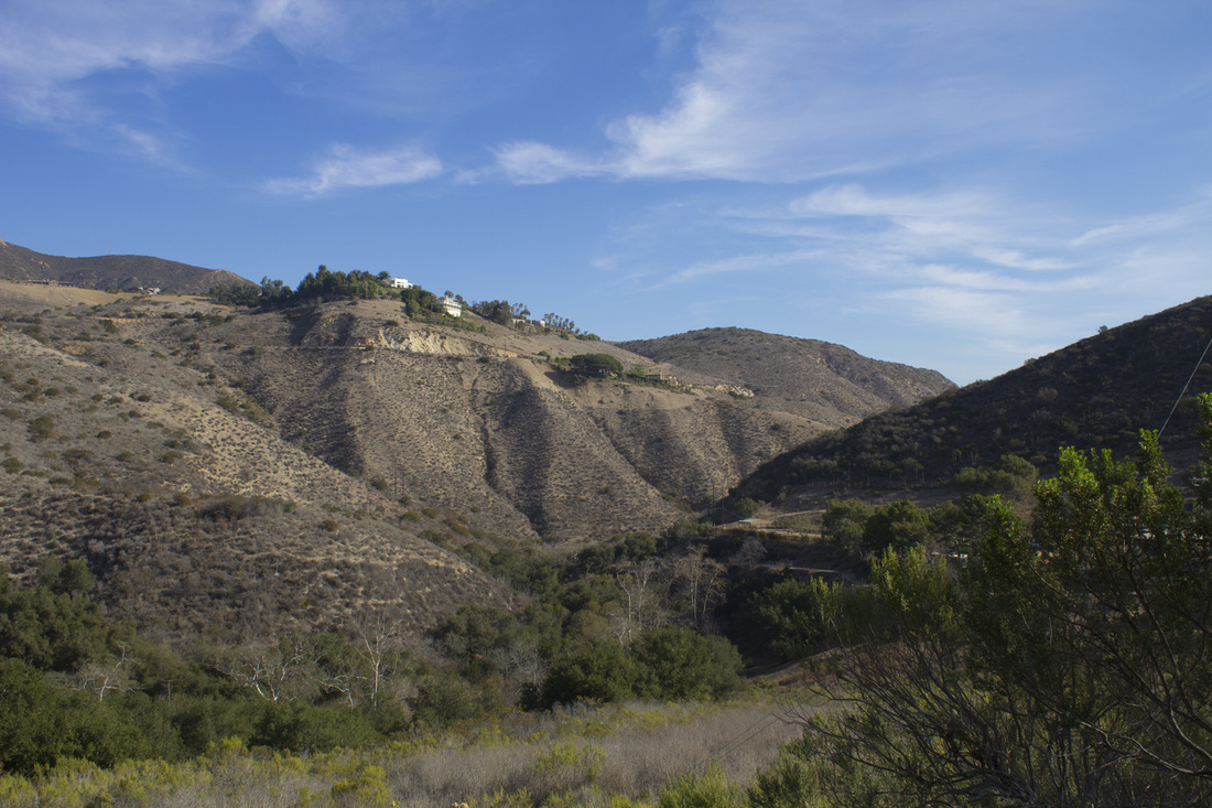
Just before the first trail junction, you will pass an information board regarding the canyon. This is a nice viewing area of the canyon and surrounding mountains. 
Trail Junction 1
A single-track use path veers off to the left and descends into the canyon. This is also an equestrian path, so you may see horses along the way. The trail is fairly narrow; give equestrians the rightof way. The path will descend approximately 100' for the next .25 before climbing steadily again all the way to the falls. 
Trail Junction 2
Just over .1 mile you will reach the next trail junction marked with a post. There may or may not be a sign on the post directing you toward Escondido Falls. Either way you will want to turn left and continue on a very gentle uphill for .5 to the next trail junction. 
Trail Junction 3
The trail emerges from under the canopy at this junction for a clear view of the sky and surrounding mountains. Turn left and continue uphill for another .5 to Lower Escondido Falls. 
End of Trail
The trail ends at the base of Lower Escondido Falls. As you enter the clearing before the falls, note the steep dirt trail to your right. This marks the ascent to Upper Escondido Falls should you decide to make the climb. 
Lower Escondido Falls, 50'
A semi-tropical setting of falling water, ferns, vines and moss greet hikers at the end of this trip. The grotto of Lower Escondido Falls feels miles away from the congested highways of Los Angeles and invites one to linger and escape the pressures of everyday life. A slight sulfuric smell lasts only a short time as one acclimates to the environment. 
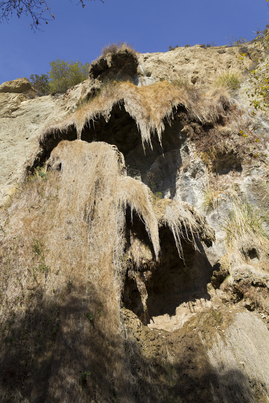
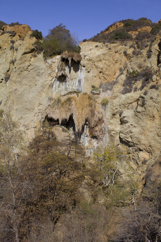
Upper Escondido Falls, 120'
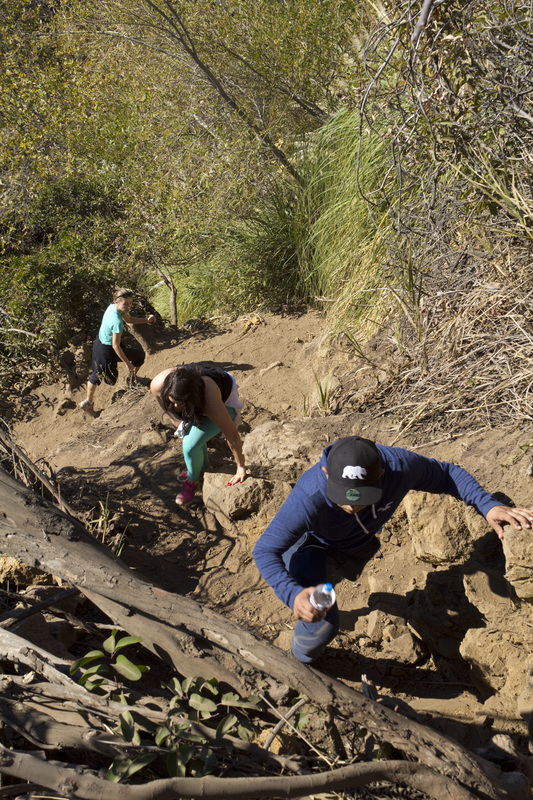
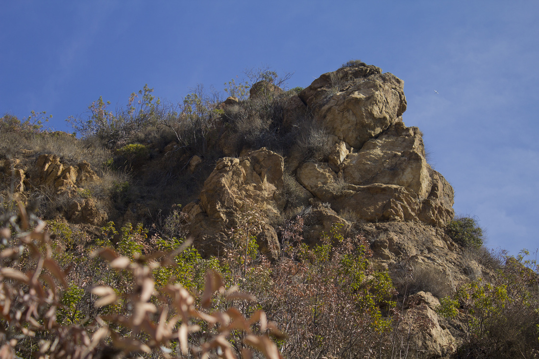
During the rainy season, a climb to Upper Escondido Falls is worth the effort. One of Southern California's most beautiful falls, the water cascades over the rocks in three tiers through overhanging moss that looks like stalactites. You can reach the upper falls in about .1 mile, but unlike the easy walk you just completed, the climb to the upper falls is just that, a climb, adding another 150' to your elevation. The soil is soft and loose with protruding rocks. A slip here could result in serious injury. Ropes have been placed by previous hikers, but I would not put my trust in someone else's knots or a rope that has been left to weather for who knows how long. Remember, your safety is your responsibility. If you make the climb, follow the trails to the left. There are numerous trails veering off to the right and away from the falls that look like main trails. If in doubt, keep to the left. Another feature that these larger trails lead to is a rock out-cropping, which many people want to climb up to for a view. The outcrop is on private land and is surrounded by barbed wire with no trespassing signs. Heed them! If you cross over the barbed wire, the climb to the outcrop is steep, and if you slip you could fall backwards into the barbed wire.
|
LIghtbox feature now active. Click on any trail photo for a larger version.
Escondido Canyon
Escondido Canyon Trail
Clearing at the Grotto
Escondido Canyon Creek (dry)
Rock Outcrop near Upper Falls
Upper Falls from Trail
|