
INSPIRATION POINT HIKE DISTANCE: 2.1 miles Roundtrip
|
TRAIL HIGHLIGHTS |
Located in Will Rogers State Historic Park, the Inspiration Point Trail is a short 2-mile hike on an easy grade. The trail mostly follows a well-groomed dirt fire road, which winds leisurely through 186 acres of park property. In fact, the trail only gains about 300' in elevation making it ideal for families with small children or folks who don't feel up for a pulse-pounding scramble up one of Los Angeles' more challenging trails. Along the way, hikers will be treated to fine views of the Los Angeles Basin, the Pacific Ocean and the Santa Monica Mountains. For those who wish to pack a lunch, picnic tables are available at the summit of Inspiration Point. The trail has two trailheads with the first being located in the parking lot directly behind the entrance kiosk and is the trailhead described in this guide Rest rooms and water are also located at this trailhead. This trailhead does begin on a spur trail and has an initial climb of about 100' in the first .1 mile to the main loop trail, nearly 1/3 of your total elevation gain. The second trailhead is located at the far end of the grassy lawn by the ranch house and is a much more gradual gain in elevation. This is the trailhead to use if you are a parent pushing a stroller or don't feel like attacking the trail quite so aggressively. The drawback to this trailhead is that it is not parking accessible and you will have to cross the length of the grassy lawn to reach it. This guide also takes hikers off the main trail for a short single-track excursion to the summit, but less adventurous hikers can remain on the main trail and reach the summit by the wide spur trail described in point 10 below.
|
Click the full frame icon in the upper right corner for a larger map in a separate window.
|
Directions to TrailheadWill Rogers State Historic Park
1501 Will Rogers State Park Road Los Angeles, CA 90272 Take the Pacific Coast Highway to Chautauqua Blvd. Head north 1.0 mile on Chautauqua to Sunset Blvd. Turn right onto Sunset Blvd. Follow Sunset Blvd. northeast for .5 mile and turn left onto Will Rogers State Park Road. Continue on Will Rogers State Park Road for .75 mile to the park entrance. Parking is $12. Free parking is available outside of the park on Will Rogers State Park Road. Park in the lot right behind the entrance kiosk. Trailhead is located on the eastern side of the parking lot. Restrooms and water are located just beyond the parking area. Parents with strollers may want to park in the next lot for closer access to the alternate trailhead. |
Inspiration Point Trail Guide
Parking
Park in the lot right after the entrance kiosk. This lot tends to fill last and is closest to the trailhead. If you don't want to pay the $12 entry fee (and support the facilities you will be using), you may park below the entrance of the park on Will Rogers State Park Road. You may have quite a hike just to get to the trailhead however. Parents with strollers may want to park at the next lot past the house for closer access to the alternate trailhead at Point #15 below. 
Rest Rooms and Water
Rest rooms are located just east of the parking lot near the visitor's center. 
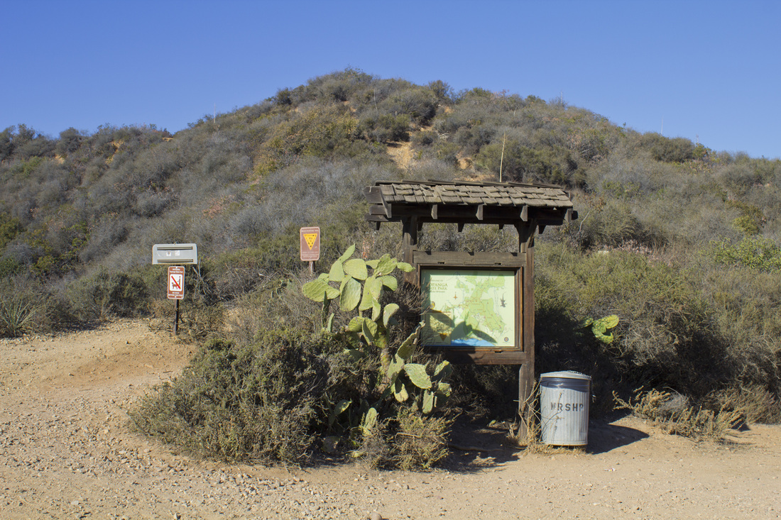
Trailhead
The trailhead begins on the eastern side of the parking lot. Climb the short hill and cross over the Rivas Canyon Trail. An alternate trailhead at the north end of the grassy area in front of Rogers' House provides easier access to the Inspiration Point Trail for parents with strollers. Technically speaking, this alternate trailhead is the official start of the Inspiration Point Trail and it avoids the moderately steep climb from the parking lot, but it is a further walk from the parking lot. 
Trail Junction 1
As you cross the Rivas Canyon Trail, continue uphill on a series of switchbacks marked with a white fence for just under .1 mile to Trail Junction 2. 
Trail Junction 2
The switchbacks end at the Inspiration Point Trail. You have climbed nearly 1/3 of your total elevation in about .1 of a mile from the parking area. From here the trail follows an easy uphill grade on a dirt fire road. In about .25 mile you will reach the first spur trail to the top of Inspiration Point. 
Observation Point 1
About .1 mile from the last Trail Junction, you will come to the first of 3 observation areas with a benches. Views here include the Pacific Ocean, Santa Monica and downtown Los Angeles. 
Observation Point 2
Another observation point with similar views. 
Observation Point 3
The third of the three observation points lies just off the main trail. Views from the position take in parts of the Santa Monica Mountains. 
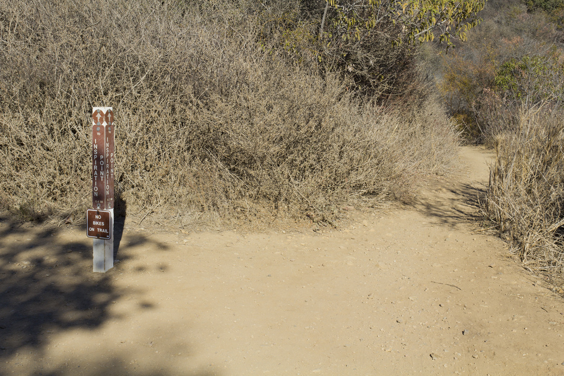
Trail Junction 3
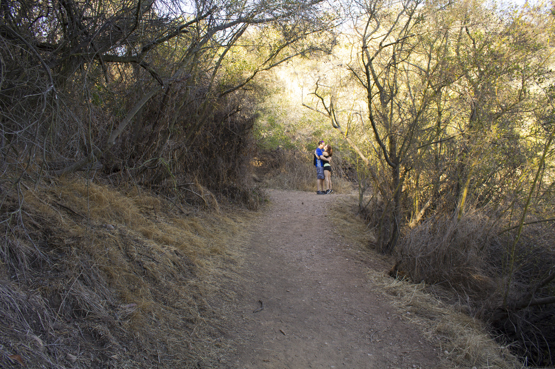
At roughly .66 mile you will reach the first of two access trails to the summit of Inspiration Point. This first spur trail follows a single-track use path through dense chaparral with a steep stair ascent just before the summit. Parents with strollers or those not wanting to climb the stairs should stay on the fire road and continue for another .3 mile to the next spur trail at Trail Junction 5, otherwise turn right onto the single-track path. 
Trail Junction 4
At about .1 mile on the spur trail, turn left into some very heavy underbrush to ascend a set of steep steps cut into the hillside. The steps will very quickly bring you to the summit of Inspiration Point. 
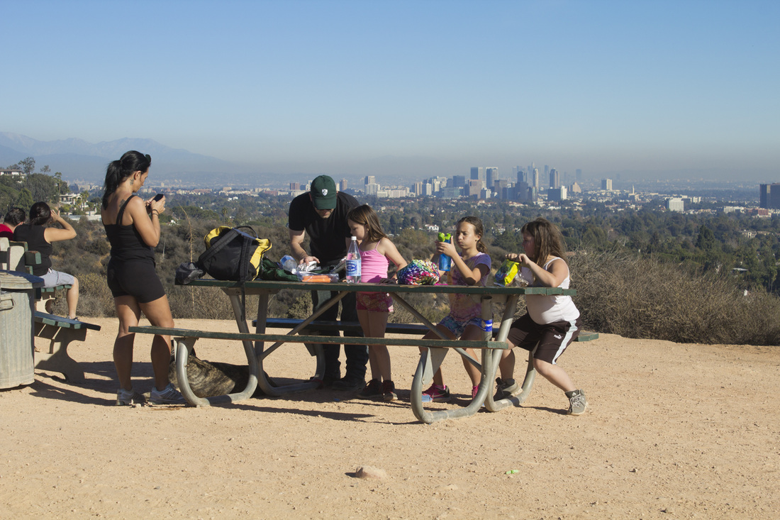
Inspiration Point, 751'
The summit is a broad flat open space with fine views of the Los Angeles Basin, Pacific Ocean, Catalina Island and the Santa Monica Mountains. There are several picnic tables nearby for those who packed a lunch, but no shade. You have completed a little less than half of your trek at this point, and the good news is it's all downhill from here. To continue your journey, follow the wide dirt path northeast to rejoin the fire road. 
Trail Junction 5
The spur trail down from Inspiration Point will make a hairpin turn to the west and bring you back down to the fire road where you will turn right. A couple of hundred yards ahead you will see a park information sign. That is the direction you should be headed. If you chose to by-pass the single-track path to the summit, this is the junction you would use to reach the summit. 
Park Information Sign
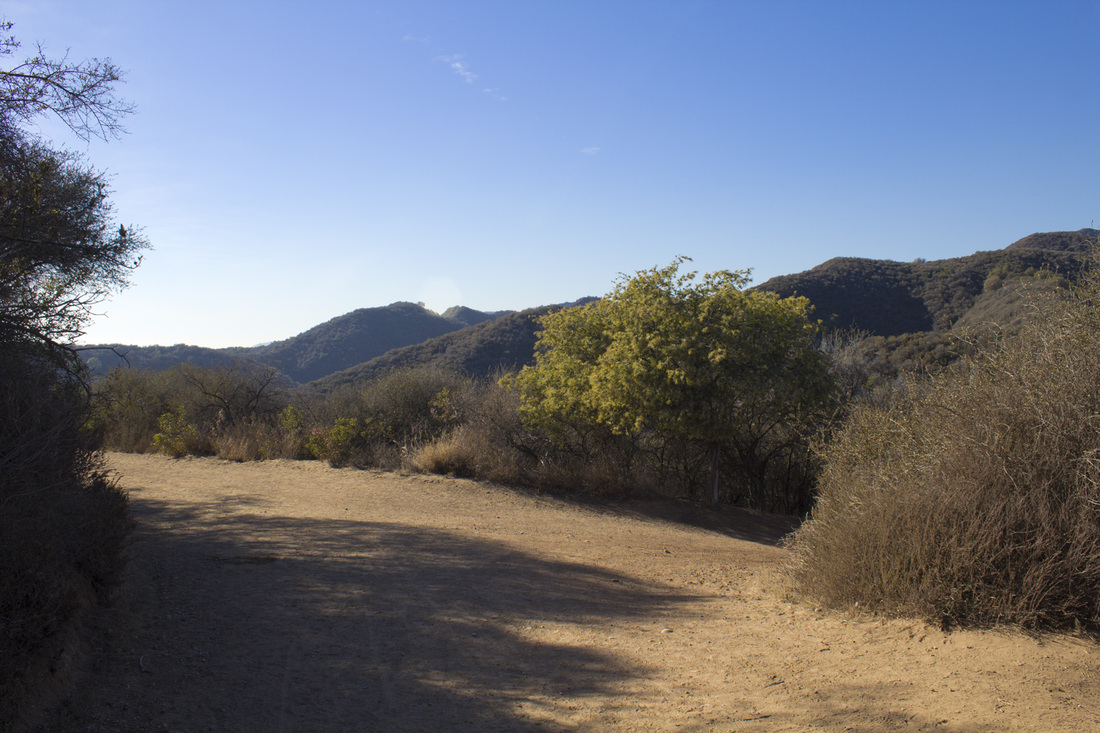
A park information signs marks the eastern terminus of the Backbone Trail, a 65-mile trail connecting Will Rogers State Historic Park with Pt. Mugu State Park. It also marks the boundary with Topanga Canyon State Park. Continue on the fire road for another .1 mile to the next trail junction. 
Trail Junction 6
This intersection offers a shortcut back to the Rogers' Ranch House, Visitor Center and parking lots. Otherwise, continue on the fire road as it winds along the western perimeter of a narrow canyon. 
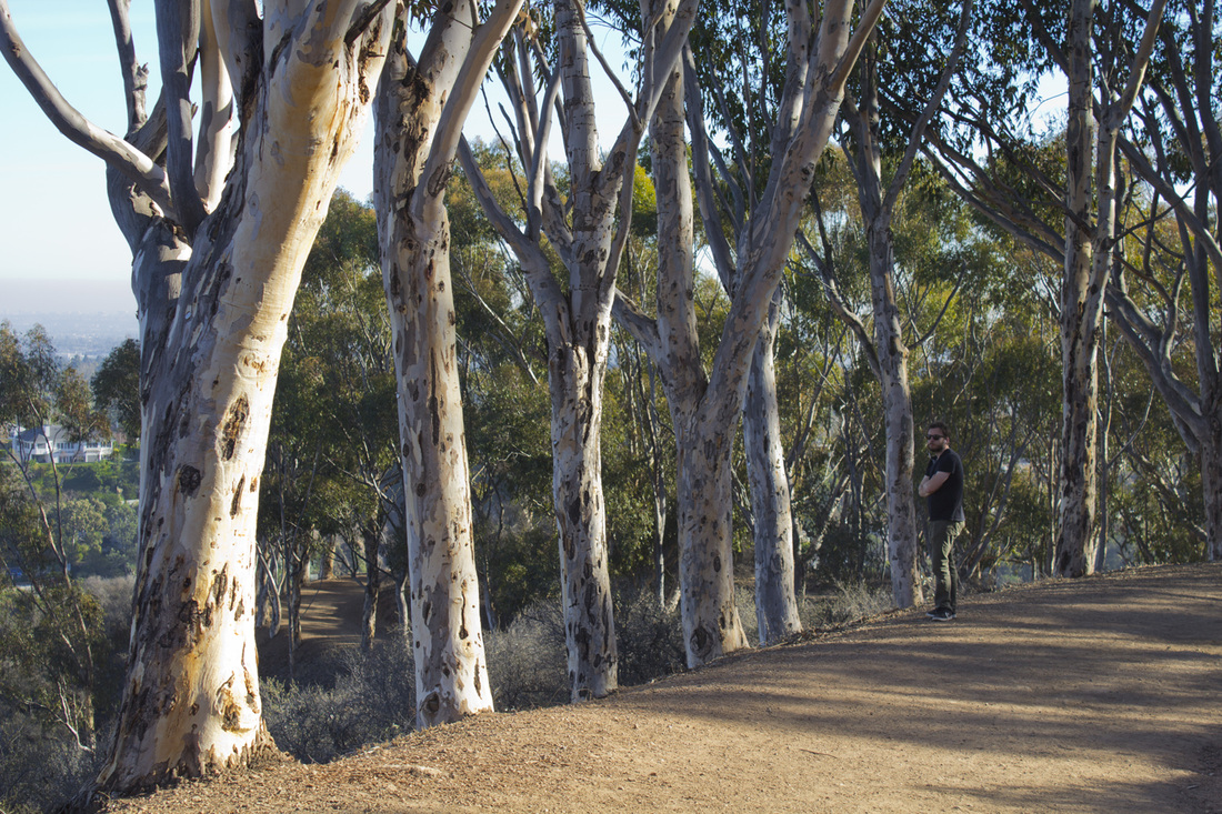
Eucalyptus Trees
At 1.5 miles you will begin a slightly steeper descent back to the parking areas, passing through a stand of beautiful and fragrant Eucalyptus Trees with grand views of Los Angeles. Along the way are some notable patches of Prickly Pear Cactus. 
Trail Junction 7
At 1.9 miles the fire road rejoins the pavement as you re-enter the developed facilities of the park. Turn left onto the pavement. Directly ahead of you about .1 mile is a park information sign. Follow the pavement to the sign. 
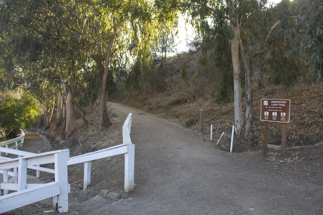
Trail Junction 8
Trail Junction 8 marks the official start of the Inspiration Point Loop Trail, but of course, you're almost done! If you were hiking the trail with a stroller or wanted to avoid the initial climb from the parking lot, this is where you would begin the trail with its easy grade on the fire road. If you're finishing the hike, you have three options at this junction. Continue uphill on the fire road to the switchbacks only to descend back to the parking lot, or take one of the two lower trails across the small white bridge. The lower trail on the left will take you to the Rogers Ranch House and Visitor's Center if you would like to explore that area; the lower trail on the right wraps behind the Rogers' Ranch House to the bottom of the switchbacks at the first parking lot and trailhead. The map follows the later trail. 
End of Trail
Congratulations! You have completed the 2.1 miles of the Inspiration Point Loop Hike. Now take some time to explore some of this historic parks other attractions, including a tour of Will Rogers home. 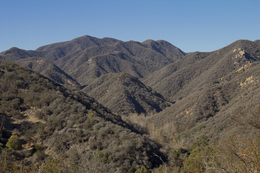
Santa Monica Mountains
|
LIghtbox feature now active. Click on any trail photo for a larger version.
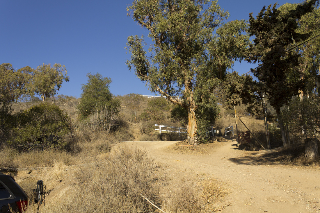
Trailhead
Trail Junction 1
Trail Junction 3
Trail Junction 4
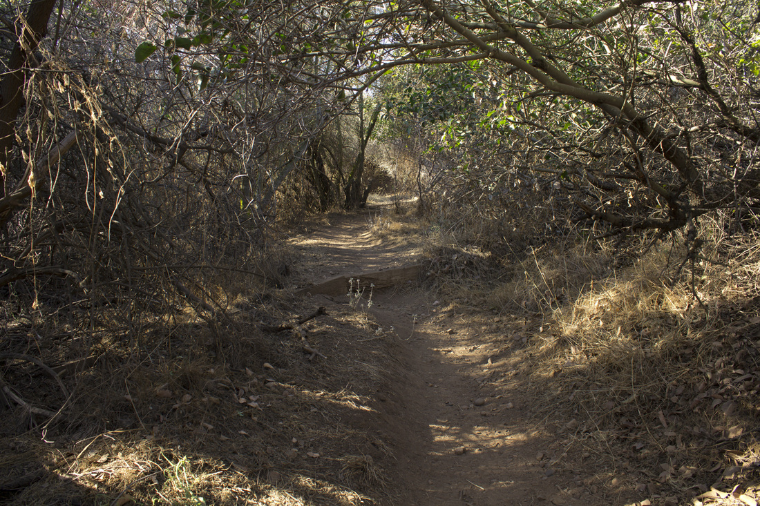
Trail Steps
Inspiration Point, 751'
Trail Junction 5
Backbone Trail Junction
Eucalyptus Trees
Trail Junction 8
|
