
MT. BALDY LOOP HIKE
|
TRAIL HIGHLIGHTS |
 Ski Hut Trail
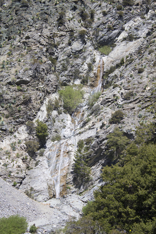
It's not just the tallest peak in the San Gabriel's, Mount Baldy is the highest peak in all of Los Angeles County, making it the must have mountain for Angelino Peakbaggers. But snagging that peak isn't easy. Mount Baldy, or Mount San Antonio as it is more properly known, rises a little over 10,000 feet above sea level with a distinctive and very steep 'bald' southeasterly face. Snow may linger on the northern slopes well into May. The summit can be reached by one of two primary trails, the combined Baldy-Ski Hut Trail from the south or the Devil's Backbone Trail from the east. These two trails can be combined into one large loop trail. Both trails begin with the same trailhead on Falls Road and continue past thte 80' San Antonio Falls a mere .6 mile into the hike. A third of a mile past the falls, the Baldy-Ski Hut Trail veers off to the left on an unmarked trail and the trail to Devil's Backbone continues on the dirt road.
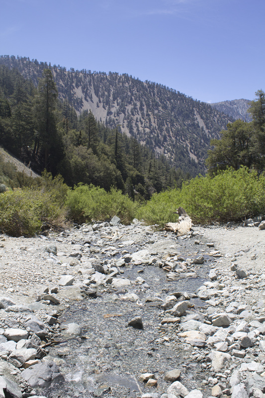
The Baldy-Ski Hut Trail is the more difficult of the two with one section gaining 500' in elevation in just 2/3 of a mile. This is also the more scenic trail of the two routes with the lower portion of the trail passing through the woodlands of San Antonio Canyon to the Sierra Club Ski Hut. The ascent to the hut is moderately steep and very consistent in its climb with few level areas. Passing the Ski Hut, hikers will cross a boulder field at the base of Baldy Bowl, the natural amphitheater formed by the southeastern slope of Mount Baldy. The climb becomes sharply steeper following the boulder field and weaves through a section of tall Jeffrey Pine. As you climb higher the vegetation thins dramatically for wide scenic views of Baldy Bowl from the western perimeter until you reach the barren summit of Mount Baldy. The trek up Baldy-Ski Hut is difficult, strenuous and long and is recommended for experienced hikers only
The Baldy-Ski Hut Trail is the more difficult of the two with one section gaining 500' in elevation in just 2/3 of a mile. This is also the more scenic trail of the two routes with the lower portion of the trail passing through the woodlands of San Antonio Canyon to the Sierra Club Ski Hut. The ascent to the hut is moderately steep and very consistent in its climb with few level areas. Passing the Ski Hut, hikers will cross a boulder field at the base of Baldy Bowl, the natural amphitheater formed by the southeastern slope of Mount Baldy. The climb becomes sharply steeper following the boulder field and weaves through a section of tall Jeffrey Pine. As you climb higher the vegetation thins dramatically for wide scenic views of Baldy Bowl from the western perimeter until you reach the barren summit of Mount Baldy. The trek up Baldy-Ski Hut is difficult, strenuous and long and is recommended for experienced hikers only
 Devil's Backbone Trail
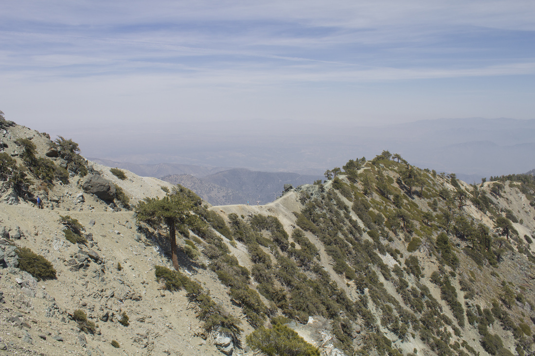
The longer, but slightly easier Devil's Backbone Trail follows the rocky ridgeline extending west from Baldy Notch to the summit. The views from the ridge are all encompassing with another sweeping vista around every turn. The trail is sometimes narrow with steep drop offs to one side or the other and alternates between lush undergrowth amid pines to suddenly barren outcroppings of rock. The lower portion of this trail is, unfortunately, somewhat uninteresting as it follows a dirt fire road for 3.5 miles from the parking lot to Baldy Notch. It's not an unattractive hike, it just lacks the expansive beauty of the upper section. Reaching Baldy Notch, however, you are rewarded with rest rooms, water fountains and a restaurant, the Top of the Notch before continuing on the Devil's Backbone. This lower section can also be bypassed on the Mt. Baldy ski lift for a nominal fee.
The guide presented below details a loop trail moving in a counter clockwise direction up to Baldy Notch, across Devil's Backbone to the summit and then descending along the Baldy-Ski Hut Trail. Options for reversing the loop or tackling either trail as an out-and-back are presented at the bottom of this page. Hiking boots are strongly recommended and hikers should take extra water.
The guide presented below details a loop trail moving in a counter clockwise direction up to Baldy Notch, across Devil's Backbone to the summit and then descending along the Baldy-Ski Hut Trail. Options for reversing the loop or tackling either trail as an out-and-back are presented at the bottom of this page. Hiking boots are strongly recommended and hikers should take extra water.
|
Click the full frame icon in the upper right corner for a larger map in a separate window.
|
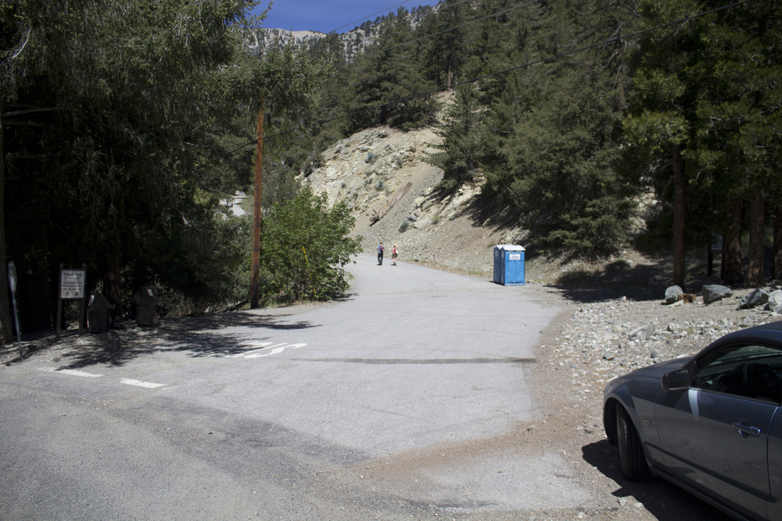
Directions to TrailheadManker Flats Campground
Mt. Baldy, CA 91759 From the 210 Freeway eastbound, exit at Basline Road, Exit 52. Make the first right onto Padua Road and continue 1.7 miles to the traffic light at Mt. Baldy Road. Turn right onto Mt. Baldy Road and continue 7 miles to Mt. Baldy Village. Stop at the visitor's center to purchase an Adventure Pass for parking. Current litigation regarding the Adventure Pass does not require the Adventure Pass to park, but this could change. Stop at the visitor center to check on the status of Adventure Passes to avoid a ticket and possible towing of your vehicle. Continue on Mt. Baldy Road for 4.4 miles to Manker Flats and park along the road. Begin hiking on Falls Road. |
Mt. Baldy Loop Hike Trail Guide
|

Mt. Baldy from Mt. Baldy Road
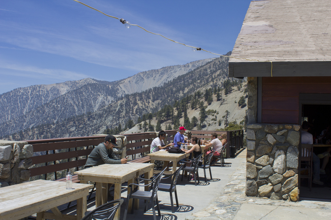
Top of the Notch
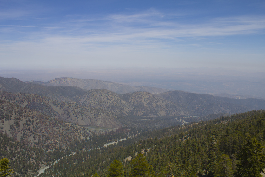
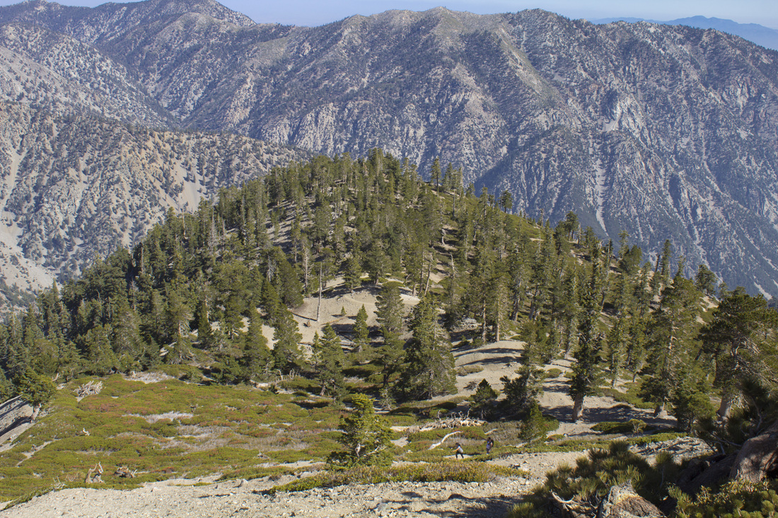
North from Devil's Backbone Trail
Devil's Backbone Bridge
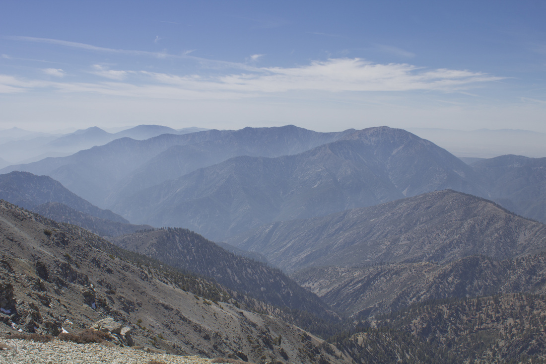
View from Summit
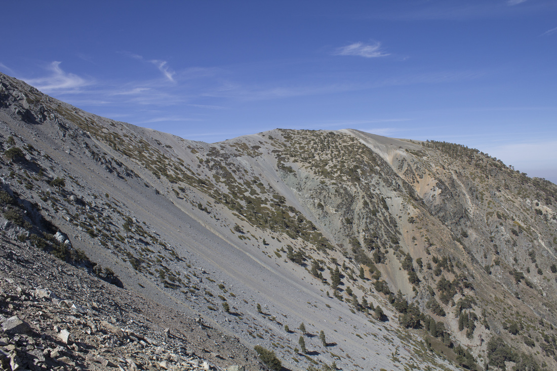
Baldy Bowl
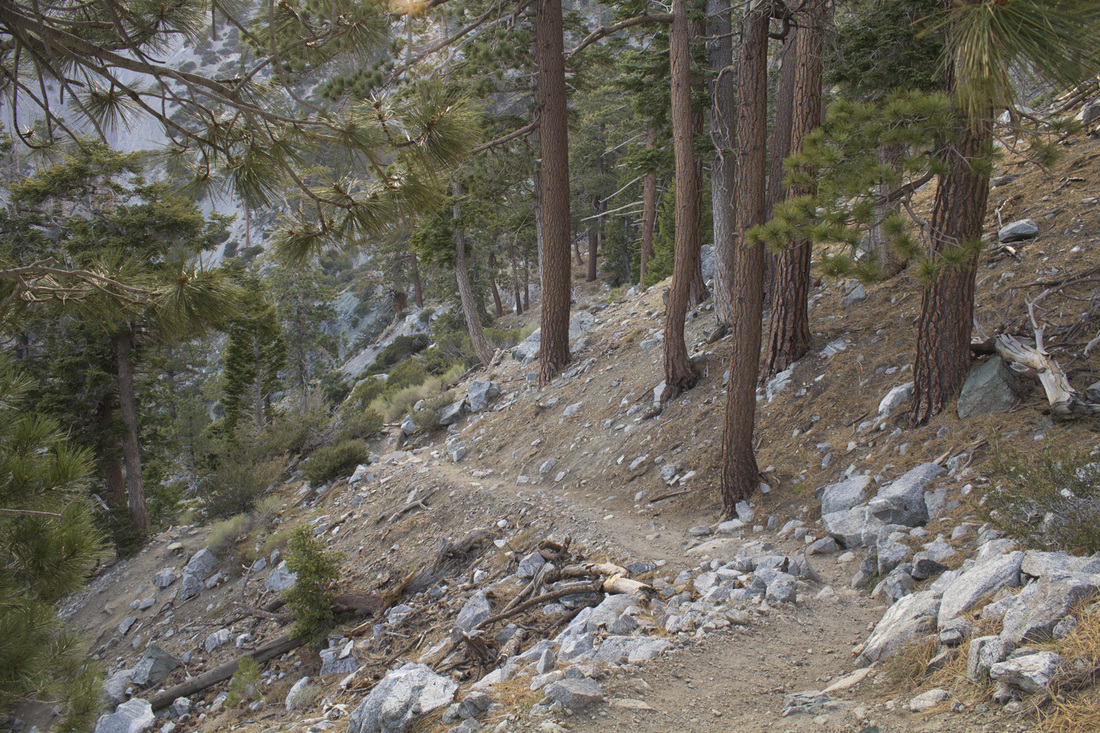
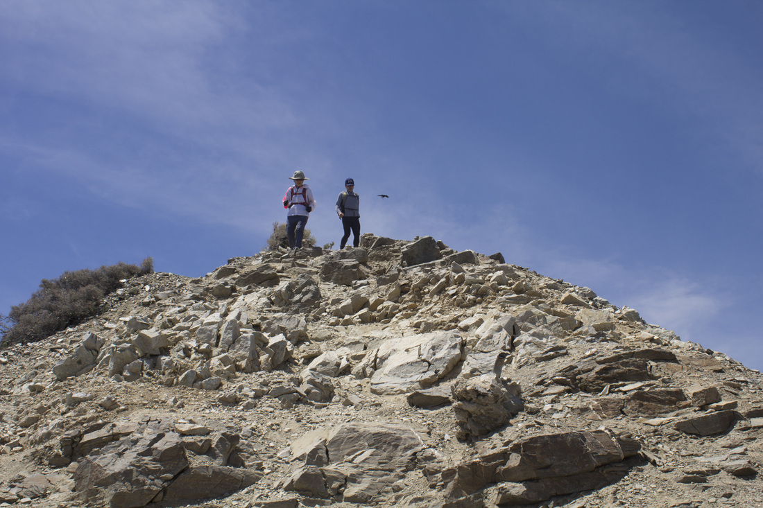
Baldy Trail-Ski Hut Trail Below Summit
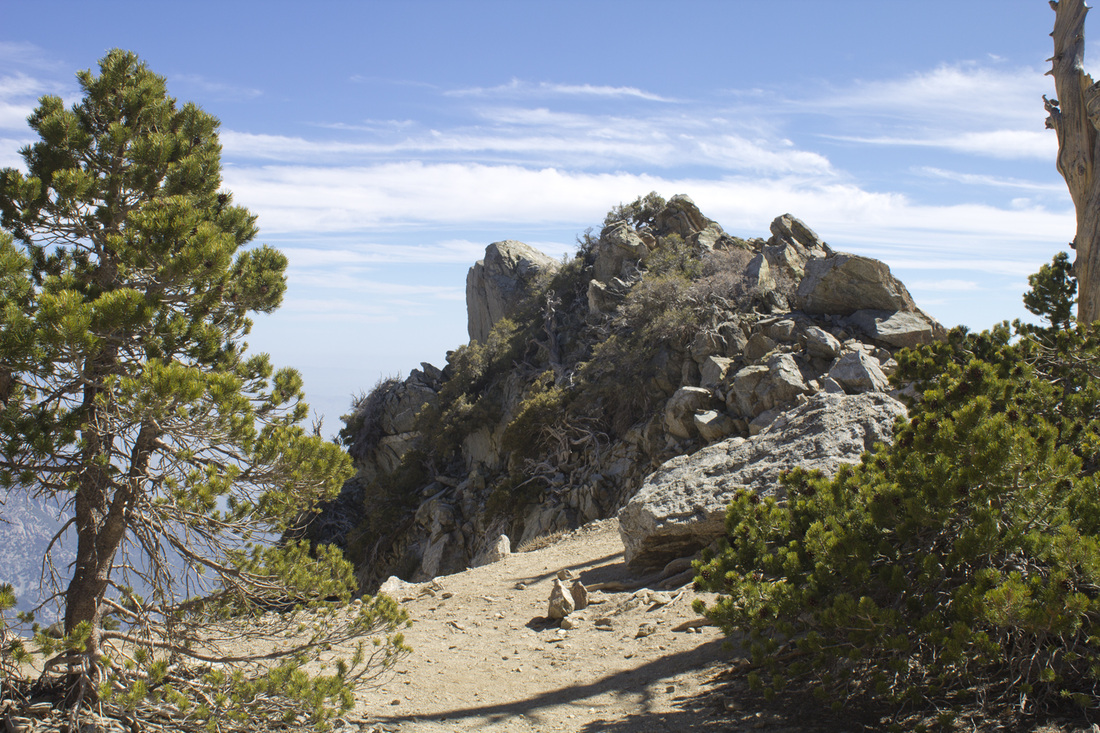
Rock Outcrop on Baldy Trail Below Summit
|


ALTERNATE ROUTES
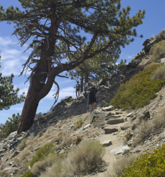
 Summit Descent on the Devil's Backbone
REVERSE LOOP (11.3 miles)
This trip simply reverses the loop described above, but is a more challenging climb, achieving the 3900' in elevation gain in just 4.5 miles on the Baldy/Ski Hut Trail as compared to 6.8 miles via the Devil's Backbone Trail. The trail begins the same on Falls Road, but .3 mile past San Antonio Falls, look for the unmarked trail angling up and to the left of the dirt fire road. The trail junction is easy to miss so be on the watch for it. From there the trail climbs consistently and moderately through San Antonio Canyon for 1.7 miles to the Sierra Club Ski Hut. After the ski hut, the trail angles westerly across a boulder field at the bottom of Baldy Bowl and then begins a stark upward climb, gaining 500' in roughly .66 of a mile through a stand of Jeffery Pine. The trail reaches a small plateau and then begins another very steep climb for about 2 miles to the summit. This section of the trail is not clearly delineated with many paths crisscrossing each other. If in doubt, simply continue moving uphill. The vegetation progressively thins as you climb the western edge of Baldy Bowl toward the summit. From the summit you will descend northeasterly on the rocky Devil's Backbone Trail along the upper rim of the bowl. As you leave the barren rim of the bowl behind, the trail will snake around the Bend of the Backbone and onto the Backbone Bridge in a rather easy descent before plunging once more down the Backbone to Baldy Notch. At Baldy Notch you will have the option of taking the ski lift down after grabbing a bite to eat at the Top of the Notch restaurant. The ski lift operates on weekends during the summer. The cost is $10 for a one-way trip or $20 for a roundtrip. One of the advantages of ending your hike with the ski lift is you will take in the most scenic areas of the hike and end at Baldy Notch for food and drinks and then avoid the least interesting part of the trail on Baldy Road with a relaxing glide down the mountain.
It should be noted that following the loop in this direction is considerably more difficult and taxing than the counter-clockwise version described above. It should only be attempted by experienced and in-shape hikers.
 Rim of the Bowl on Devil's Backbone
DEVIL'S BACKBONE OUT-AND-BACK (9 miles roundtrip)
The Devil's Backbone is the easiest of the two major routes to the summit of Mt. Baldy, but that doesn't mean it isn't challenging. The lower half begins on Falls Road and passes San Antonio Falls. At the falls, the road hairpins to the right and continues on the unpaved Baldy Road. The climb is a strong moderate ascent to Baldy Notch. This section of trail is the least interesting visually of all the ascents to the summit with no great vistas or notable features. Once you reach Baldy Notch, that will change considerably. The sky opens up with grand views of the surrounding mountains and the Mojave Desert to the north as you begin to climb the moderately to often strenuous Devil's Backbone Trail. The trail levels off slightly as you cross Devil's Backbone Bridge and snake around the Bend of the Backbone on a narrow singletrack trail with steep drop offs. The vegetation thins out as you approach the rim of Baldy Bowl, and the rocky, scrabbly ground may feel slushy underfoot in sections. The final push is a very steep, rocky climb to the summit. After enjoying the views from the highest point in the San Gabriel Mountains, retrace your steps down Devil's Backbone to Baldy Notch and then down the fire road to the parking area.
One option to avoid the less interesting trek below Baldy Notch is to take the ski lift from the parking area to Baldy Notch. The ski lift operates on weekends during the summer and is $10 one-way or $20 roundtrip. You will have a shorter, but more scenic hike along the Backbone capped off with dinner and drinks at Top of the Notch and then a relaxing glide down the mountain.
 Sierra Club Ski Hut
BALDY TRAIL - SKI HUT TRAIL (6.8 miles roundtrip)
Utilizing the Baldy/Ski Hut trail provides an incredible challenge to hikers and takes in the most scenic sections of the larger loop trail while cutting considerable mileage from that hike. The tradeoff is that you will be climbing and descending the steepest sections of the loop, which can prove challenging even to experienced hikers. The trail begins the same on Falls Road, but .3 mile past San Antonio Falls, look for the unmarked trail angling up and to the left of the dirt fire road. The trail junction is easy to miss so be on the watch for it. From there the trail climbs consistently and moderately through San Antonio Canyon for 1.7 miles to the Sierra Club Ski Hut. After the ski hut, the trail angles westerly across a boulder field at the bottom of Baldy Bowl and then begins a stark upward climb, gaining 500' in roughly .66 of a mile through a stand of Jeffery Pine. The trail reaches a small plateau and then begins another very steep climb for about 2 miles to the summit. This section of the trail is not clearly delineated with many paths crisscrossing each other. If in doubt, simply continue moving uphill. The vegetation progressively thins as you climb the western edge of Baldy Bowl toward the summit. After resting at the summit, retrace your steps down Baldy/Ski Hut Trail to the parking area.
It should be noted that this trail is is considerably more difficult and taxing than the alternate Devil's Backbone out-and-back. It should only be attempted by experienced and in-shape hikers.
