Subscribe
HIKE LOS ANGELES
  • Home
  • Destinations
    • Griffith Park >
      • Mt. Hollywood
      • The Lonesome Pine
      • Bee Rock
      • Griffith Park Trail Run
      • Amir's Garden
      • Royce's Canyon
      • Hollywood Sign
      • Cahuenga Peak Hike
    • Santa Monica Mountains >
      • Escondido Canyon Hike
      • Inspiration Point Hike
      • Sandstone Peak Hike
      • The Grotto Hike
      • Calabasas Peak Hike
      • Paramount Ranch Hike
      • Fanklin Canyon Lake Loop Hike
    • San Gabriel Mtns./Angeles National Forest >
      • Sturtevant Falls Hike
      • Eaton Canyon Hike
      • Mt. Baldy Loop Hike
      • Echo Mountain Hike
      • Trail Canyon Waterfall Hike
      • Monrovia Canyon Waterfall Hike
      • San Gabriel Peak/Mt. Disappointment Hike
      • Mount Lowe Hike
      • Switzer Falls Hike
    • Verdugo Mountains >
      • Verdugo Peak
      • Mt. Thom Hike
      • Verdugo Sunset Hike
      • Cross of San Ysidro Sunrise Hike
    • Santa Susanna Mountains >
      • Oat Mountain Hike
      • Rocky Peak Hike
      • Don Mullally Trail Hike
      • Towsley View Loop Trail
  • Specialty Hikes
    • Sunrise/Sunset Hikes
    • Waterfall Hikes
    • Historic Hikes
    • Hollywood Sign
    • The 5 Peaks
  • Resources
  • Blog

   SLATE MAGAZINE'S
   BEST SWIMMING
   HOLES IN LA

       With summer approaching, now is the time to plan
       your visits to some of LA's best swimming holes with
​       Michael Juliano's list of best spots to beat the summer
       heat.

Los Angeles Swimming Holes

Monrovia to Open Final Access Point to Hillside Wilderness Preserve

5/24/2016

2 Comments

 
Monrovia Hillside Wilderness
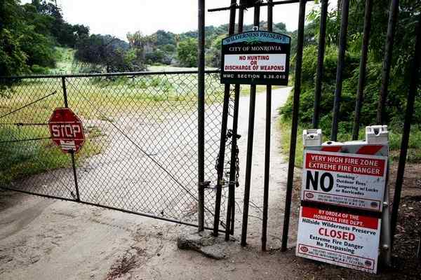
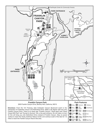
The final access point located on Cloverleaf Drive
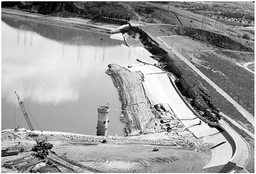
The fourth and final access point to the Hillside Wilderness Preserve will finally be open to residents, nearly 16 years after voters adopted two measures to save the hillsides from development. But before access can be granted, the city will need to spend $350,000 to purchase two easements from private property owners to access the trail, which City Council authorized last week, along with allocating an additional $100,000 for capital improvements in the area.

“It’s been a community priority for many years to resolve this particular issue and we think this is a sensible way to bring closure to the matter,” City Manager Oliver Chi said.

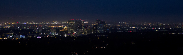
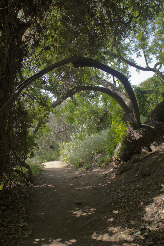
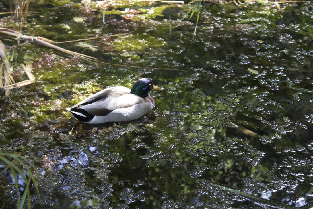
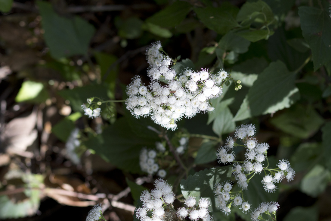
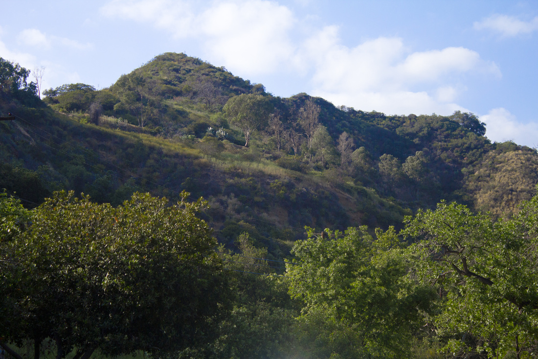
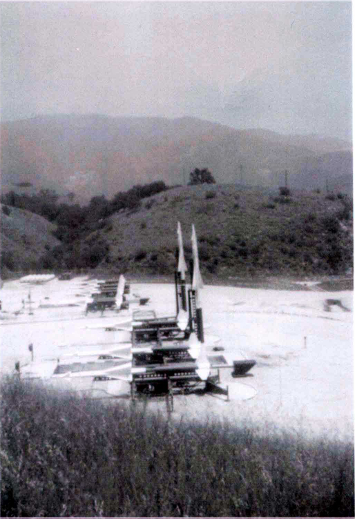
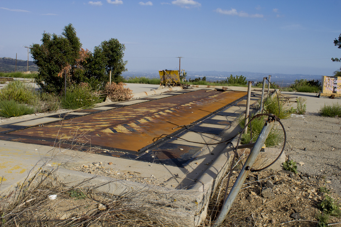
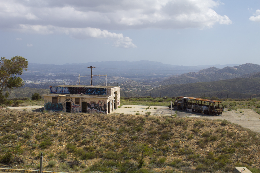
The 1,416 acres of wilderness offers several trails that give hikers and bikers a breathtaking view of Los Angeles and look directly upon Arcadia and Monrovia. The area is home to rare, native species and wildlife and — on a clear day — offers views straight to Santa Catalina Island.

Read Courtney Tompkins full article in The Pasadena Star-News HERE.


2 Comments

Franklin Canyon Park - Los Angeles' Hidden Oasis

4/22/2015

2 Comments

 
Franklin LakeFranklin Lake, Franklin Canyon Park
Nestled between Benedict and Coldwater Canyons on 605 acres of land is a hidden oasis of natural beauty: Franklin Canyon Park. This charming and idyllic spot offers a unique sense of seclusion that cannot be found at Tree People/Cold Water Canyon Park just a short distance away, or at the larger Griffith Park, overrun as it is with tourists scrambling to see the Hollywood Sign, hike to the Observatory or ride the Carousel. In fact, wandering the path around Franklin Lake or relaxing on the grassy field of Franklin Canyon Ranch, it is easy to forget that you are mere minutes from the hustle and bustle of Greater Metropolitan Los Angeles. That’s not to say there are no people in the park, it’s just that they seem to move at a slower, more relaxed pace. It also helps that there are fewer of them. This is due in part to the fact the park can be difficult to find if you don’t know where it is. No signage exists on the northern approach, and the southern entrance offers only one sign. As a result, parking is seldom a problem, even on weekends.

Franklin Canyon Park Night
Skyline on Moonlight Hike

Hiking Franklin Canyon

Franklin Canyon ParkOak Arches on the Discovery Trail
The park offers over 5 miles of hiking trails, some featuring fantastic views of West Hollywood and even downtown Los Angeles. Hardcore hikers will find little challenge on these short loops, but novice hikers and families will find them just about perfect. The loop around Franklin Lake is wide and level, making it perfect for moms pushing strollers. The water views around the lake are quite nice and are unlike any other you are likely to find in the area. The adjacent Heavenly Pond Trail is ADA compliant for those with mobility issues. The Hastain Trail at the southern end of the park is used for guided monthly full moon hikes and offers some gorgeous nighttime views of the Los Angeles Basin. In addition to the trails and lakes, the park offers educational activities in the Sooky Goldman Nature Center and William O. Douglas Outdoor Classroom.

Franklin Canyon Park Hiking Trails
Franklin Canyon Hiking Trails

Flora and Fauna in the Canyon

The bottom of the canyon is a rich, dense riparian landscape irrigated by a steady flow of water from Franklin Lake. Several underground springs also add to the watershed, creating a lush landscape year round. As you work your way up the slopes of the canyon, the canopy of oak, walnut and sycamore gives way to the more common chaparral of Southern California. The park is also a birdwatcher’s paradise being home to eagles, horned owls and seven different species of hawks. Franklin Lake and Heavenly Pond are nesting grounds for both Mandarin and Wood Ducks. 
California Thistle
California Thistle
Wildflowers
Mallard Duck
Wildflowers
Wildflowers

William Mulholland and the History of Franklin Canyon

LA Aqueduct from Owens ValleyLA Aqueduct from Owens Valley
Though not officially designated as parkland until 1981, the origins of the park as we know it today began in 1914. By the turn of the 20th Century, Los Angeles was already a thirsty town and Mayor Fred Eaton sought to quench that thirst by acquiring water rights from the Owens Valley to the east of the city. That these rights may not have been secured through strictly legal means remains a bitter controversy in many parts outside of the metropolitan area t this day. Whether legal or not, the rights were acquired and a 223-mile aqueduct was completed in 1913. The following year William Mulholland and the DWP (Department of Water and Power) began construction on two reservoirs in the upper reaches of the canyon to store and distribute water diverted from the Owens Valley. So much was water was diverted from Owens Valley by Mulholland’s aqueduct that farming became unsustainable by the early 20s and by 1926, just 13 years after the aqueduct opened, Owens Lake was completely dry.

Franklin Canyon Park
Owens Lake Today
Though the Owens Valley began to blow dust, Franklin Canyon, thanks to a steady supply of water from both the new reservoirs and a series of underground springs, began to bloom setting the stage for the unique ecological environment that exists today. But it wasn’t only Mulholland and the DWP that had a hand in shaping Franklin Canyon. Around the same time as Mulholland was constructing his reservoir, the family of oil magnate Edward L. Doheny purchased the land in the lower canyon for watering and grazing cattle. In 1935, the Doheny’s expanded their presence in the canyon by builing a modest Spanish Adobe style home as a summer retreat. The house still stands today as the Franklin Canyon Ranch and houses park personnel. So well before the US entered WWII, the basic building blocks of today’s park were already in place, and they remained untouched for nearly 40 years until the Sylmar Earthquake of 1971.
Lower Van Norman DamEmbankment Failure, Lower Van Norman Dam
The earthquake, measuring 6.7 on the Richter Scale, occurred at 6 A.M. on February 9 in the northeast corner of the San Fernando Valley. The massive trembler caused extensive damage throughout the valley including the near collapse of Lower Van Norman Dam. As a result, the city and the DWP began a system wide survey of its dams and reservoirs. The Franklin Canyon Reservoirs were deemed at high risk for failure. The lower reservoir was emptied completely and the upper reservoir level was lowered by 15’. A new, modern reservoir and surge dam were constructed below the Doheny Ranch as a replacement. With the upper reservoirs decommissioned and the Doheny Ranch properties slated for sale, the once protected Franklin Canyon was now open for development. Fortunately, Sooky Goldman, a political organizer and conservationist, had other plans. She had a vision for the canyon that included not only preserving the natural state of the canyon, but creating an education center that would enable inner city children to connect with California’s natural resources.

Franklin CanyonFranklin Canyon from Hastain Trail
Enlisting the help of Congressman Howard Berman, Ms Goldman convinced the National Park Service to acquire the Doheny holdings as part of the Santa Monica Mountains National Recreation Area and the DWP to donate the upper reservoir property as parkland. The new Franklin Canyon Park, combining both properties, was opened to the public in 1981. Improvements to the property included the construction of the Sooky Goldman Nature Center, the William O. Douglas Outdoor Classroom and the Heavenly Pond. Activities at the park include native arts and crafts, photography and moonlight hikes and natural resources education, all presented free of charge. But man is not the only force working to restructure the park, nature is playing a hand as well. With the lowering of the water level in Franklin Lake (the former upper reservoir), grassy reeds have taken root on the northern perimeter of the lake, creating a marshy area that has become a waterfowl habitat. The reeds are currently encroaching on the southern end of the lake around the dam. As the grasses die off each season, the decaying vegetation is silting up the bottom of the lake. If this cycle continues unabated, the lake will eventually dry up and the ecology of the canyon will change once more, albeit to the more natural state that existed prior to the construction of the reservoir. The decision to be made will be whether to let nature take its course or let man preserve the idyllic oasis he inadvertently created.

For more information on Franklin Canyon Park and its scheduled activities, visit Franklin Canyon Park or Franklin Canyon NPS.

Directions to the Park

From the Valley:  Exit the Ventura Fwy (the 101) at Coldwater Cyn Dr. and proceed south for 2.5 miles. At intersection with Mulholland Dr and Franklin Cyn Dr (directly across from Tree People and Coldwater Canyon Park), turn right on Franklin Cyn Dr. You will reach the park’s northern gate in approximately .25 mile. A .25 mile past the gate will bring you to William O. Douglas Outdoor Classroom and Sooky Goldman Nature Center parking area. To reach Franklin Canyon Ranch, continue on Franklin Canyon Dr. for another .66 mile and turn left onto Lake Dr. You will reach the parking area in about .66 mile.)

From Beverly Hills: From Sunset Blvd, turn north on Beverly Dr. Continue on Beverly Dr. by veering left at the “to Coldwater Cyn Dr.” sign, then left at the intersection with Coldwater Cyn Dr (look for Beverly Hills Fire Station #2). Turn right on Franklin Canyon Dr. and proceed north for 1.1 miles, passing through the park’s southern gate along the way. At the 1.1 miles mark, you may turn right onto Lake Dr. for .66 mile to reach the Franklin Canyon Ranch section of the park, or continue straight on Franklin Canyon Dr. to pass around the eastern side of Franklin Lake and reach Sooky Goldman Nature Center and William O. Douglas Outdoor Classroom.

The Park as Movie and TV Locations

Claudette Colbert
Claudette Colbert, It Happened One Night
The Andy Griffith Show
The Andy Griffith Show, Opening Credits
Star Trek
Star Trek, TOS
2 Comments

City Opens Closed Road to Traffic in Griffith Park

4/1/2015

1 Comment

 
The City of Los Angeles recently opened a section of Mount Hollywood Drive that has been closed to traffic since 1991for a feasibility study on relieving traffic congestion around the Griffith Observatory. Part of the reason for the increase in traffic is due in part by the city trying to relieve traffic congestion (and soothe angry neighbors) in the Beachwood Canyon area. With Los Angeles seeing an uptick in tourism, out-of-towners have flooded the canyon to snap pictures of the fabled Hollywood Sign. City planners means of handling the situation was to simply redirect traffic to the eastern side of Griffith Park and anger homeowners in the Vermont Avenue Ferndell Avenue areas. Vermont Avenue already sees it fair share of traffic with access to both the observatory and the Greek Theatre. Shifting additional traffic there seems little more than a poke in the eye to the neighborhood residents. As a result, the city decided to turn 1.1 miles of the formerly closed Mount Hollywood Drive into a temporary parking lot. This has the double result of inviting more cars to enter the park through Vermont and Ferndell Avenues while reducing the 'wilderness' area of the nation's largest urban wilderness park. While the city is calling this a temporary decision and a feasibility study, outdoor enthusiasts are already rallying to prevent the situation from becoming permanent. A petition is already circulating on change.org asking for a ban on cars and trams on Mount Hollywood Drive. You can find the petition here. Sandi Hemmerlein has also written an informative article on the situation for KCET as shown below.

1 Comment

Thaddeus Lowe and the White City in the Sky

10/23/2014

6 Comments

 
PictureThe White City, circa 1895
High on promontory above the town of Altadena, CA, there once was a dazzling Victorian resort known as The White City in the Sky. This ‘city’ was comprised of a 40-room chalet, astronomical observatory, zoo, dormitories, dance hall, bowling alley, tennis courts, picnic areas, machine shops and, the jewel of the city, the palatial 70-room Echo Mountain House. The entire complex of buildings was painted a brilliant white to reflect the southern California sun. Situated as it was at the tip of Echo Mountain, the resort could be seen glowing against the backdrop of the San Gabriel Mountains (then called the Sierra Madre Mountains) from downtown Los Angeles, some 13 miles distant. The resort was part of a series of hotels and taverns built to service the Mount Lowe Railway.

PictureThaddeus Lowe, circa 1865
The railway was the dream project of Professor Thaddeus Lowe and his engineer partner, David J Macpherson. At the time of the project’s undertaking, Professor Lowe had retired to southern California after having already lived a rather adventurous life. Entering this world in August of 1832, Lowe was one of five children born to Clovis and Alpha Lowe of Jefferson Mills, NH. Around the age of 10, Lowe’s mother passed away and his father remarried to Mary Randall and, by some estimates, sired another 7 children. Unable to support such a large brood, Lowe’s father boarded the young boy with a nearby farm. Unhappy with what was essentially an indentured servitude, Thaddeus ran away at the age of 14 to join his older brother in Boston where he began work as a shoe cutter.


While recovering from an illness at age 18, Lowe attended a travelling road show demonstrating the uses of lighter-than-air gases led by Professor Reginald Dinkelhoff. Fascinated by the science, Lowe joined the show as Dinkelhoff’s assistant and 2 years later bought the show when Dinkelhoff retired. Within five years, Lowe, using his knowledge of lighter-than-air gases, had become one of America’s premiere balloonists, creating a lucrative business giving balloon rides at state and county fairs. During one of his lecture-exhibitions, Lowe met a 19-year old Parisian actress, Leotine Agustine Gaschon. One week later on February 14, 1855, the pair were married. Over the course of their marriage Leotine would give her husband ten children, seven boys and three girls.

In 1859, Lowe constructed a massive 103-foot diameter balloon named the City of New York with the intent of making a transatlantic flight. The balloon, later renamed the Great Western, made several successful test flights, but before the transatlantic voyage could be undertaken, the American Civil War broke out. Two days after the state of Virginia seceded from the Union, Lowe attempted to reach the eastern seaboard from Cincinnati in the balloon Enterprise. Unfortunately for Lowe, the balloon went off course and he landed in Unionville, SC where he was promptly taken prisoner as a Yankee spy by Confederate forces. After some careful negotiation where Lowe pleaded his case as a man of science, the professor and his balloon were released. 

Picture
The Intrepid at the Battle of Fair Oaks, 1862
The incident opened up new possibilities for Lowe and in July of 1861, he offered to demonstrate the surveillance capabilities of his balloon for President Abraham Lincoln. Floating 500’ above the White House Lowe sent the first aerial dispatch by telegraph. Lincoln and his war department seized upon the idea of aerial surveillance and real-time troop movements relayed to commanders in the field. Lowe was given the go-ahead, and he flew in battle for the first time during the First Battle of Bull Run. So impressive was his flight that Lincoln ordered the formation of the Union Army Balloon Corps with Lowe named as Chief Aeronaut. Lowe would eventually command seven balloons with the corps, even launching them from a converted coal barge, effectively creating America’s first aircraft carrier. During his time with the Union Army, Lowe contracted malaria, an affliction that would bother him for the remainder of his life.
Following the war, Lowe moved to Norristown, PA. He continued experimenting with hydrogen and acquired 200 patents for his inventions. His most successful enterprise was a water gas process that generated large quantities of enriched hydrogen for heating and lighting, earning him a fortune in the process. In 1887, Lowe retired to Pasadena, CA with the hopes the dry climate would ease the lingering ailments from his bout with malaria. It was there he met the engineer David Macpherson. With Macpherson’s engineering skills and Lowe’s financial resources, the two hoped to create a rail line that would ride the crest of the San Gabriel Mountains to Mount Wilson. Unfortunately, the pair were unable to obtain all the necessary rights-of-way and so rerouted their planned railway to Oak Mountain (later named Mount Lowe) via the Echo Mountain promontory above Altadena.
The first section of rail began service on Independence Day of 1893. It ran from Lake and Calaveras in Altadena to Rubio Pavilion, a 12-room hotel at the entrance of Rubio Canyon. Passengers could then transfer to a funicular incline railway climbing the canyon to Echo Mountain. In 1894, the grand Echo Mountain House Victorian resort was opened, and in 1896, the final leg of the railway was completed to the Ye Alpine Tavern in Grand Canyon at the base of Mount Lowe. In all, there were nearly 7 miles of track.

The Echo Mountain house was a grand and stately structure capped with an imposing dome. A large porch for socializing ran along the front and two wings of the building, providing spectacular views of Pasadena, the San Gabriel Valley and even Catalina Island 65 miles away. The interior of the hotel was completed with natural wood and held a curio shop, a Western Union office, billiard room, shoeshine stand and barbershop among other amenities. To the left and right of the domed lobby were two wings of rooms for guests, while to the rear of the lobby was a formal dining room with views of Castle Canyon and Mount Lowe. Atop the incline railway powerhouse located in front of the resort, a 3-million candlepower searchlight had been installed that could be seen up to 50 miles at sea.  Lowe’s publicist, George Wharton James, took that a step further and claimed he could read his newspaper from the beam’s power shining through his window on Catalina Island. On the ridge behind Echo Mountain House was an astronomical observatory featuring a 16” telescope. Visitors could spend their days playing tennis, bowling, taking mule rides into the mountains or listening to their voices echo across Castle Canyon on several echophones installed along the rim of the canyon. At night there was a white-linen dinner service prepared on dishes etched with the resorts logo followed by dancing. The luxuriousness and sheer spectacle of the resort along with the incredible scenery quickly made the White City the top honeymoon destination in America. Unfortunately, the cost to construct and maintain the railway and the hotels proved to be too much for Lowe and the project fell into receivership. In 1899, only six years after it opened, the professor lost everything except for title to the observatory. But that was only the beginning of the end for the White City.
Picture
A funicular car, aka a White Chariot, at the summit
Picture
Mt. Lowe Incline Railway, circa 1895
Picture
Funicular car arriving at Echo Mountain House, circa 1895
PictureInterior Echo Mountain House, circa 1895
In 1900, a kitchen fire destroyed the Echo Mountain House, leaving only the foundation in its wake. The building had not been properly insured and thus was never rebuilt. In 1905, a second fire destroyed all the remaining buildings with the exception of the observatory. The incline railway powerhouse was rebuilt in 1906, but the rest of the property on Echo Mountain was left in ruins. In 1909, a flash flood destroyed the Rubio Pavilion hotel at the bottom of the funicular incline railway. The observatory held on until 1928 when a particularly strong Santa Ana wind blew the building down. The curator managed to escape moments before the collapse, taking the expensive telescope with him. Despite the catastrophes, the railway continued to operate under various owners, hauling passengers to the Mount Lowe Tavern (the renamed Ye Alpine Tavern) at Mount Lowe until 1936 when the tavern also succumbed to fire. The railway was now a line without a destination. As such, the railroad’s booster club organized one final excursion, and in December of 1937, the Mount Lowe Railway made its last public trek past the remains of the White City to the burnt ruins of the Mount Lowe Tavern. In March of the following year, a three-day thunderstorm washed the railroad itself from the mountain. What little remained of the buildings that once graced the promontory of Echo Mountain was declared a hazardous nuisance and blasted into history with dynamite by the US Forest Service between 1959 and 1962.

Echo Mountain Today

Today, all that remains of Professor Lowe’s dream are some foundations marking the location of the Echo Mountain House and it’s periphery buildings. The grip and guide wheels from the funicular powerhouse lay trailside, rusting in the bright California sun. On the rim of Castle Canyon, a replica echophone has been installed, allowing hikers to hear their voices reverberating across the canyon as tourists did more than 100 years ago.

The easiest way to reach the ruins of the White City is via the Sam Merrill Trail located at the intersection on Lake Avenue and East Loma Alta Drive in Altadena, CA. For trail details, click here.
6 Comments

Mount Rainier Hikers Feared Dead

6/1/2014

0 Comments

 
PictureMt. Rainier, Washington
Search helicopters have detected emergency locator beacons buried in the snow on Mount Rainer. Six climbers, two guides with four clients, were reported missing on Friday evening when they did not return as expected. The pings from the locators are registering in an area several thousand feet below the climber's last reported position. Park officials believe the expedition fell up to 3,300' in an avalanche prone area. Climbing gear was also spotted scattered across the section where the pings are coming from. Rescue and recovery efforts have been suspended at this time. Park Ranger Fawn Bauer told the AP News Service there was no viable chance of survival from such a fall. Falling rock and ice are currently preventing any recovery efforts. Bauer added, "In all honesty, we may never be able to get on the ground there." Names of the climbers are being withheld pending notification of the next of kin. More information can be found in this AP News story.

0 Comments

Hike Through History at Oat Mountain's LA-88 Missile Base

5/23/2014

4 Comments

 
Picture
Radiation Warning on Bunker Doors, LA-88 Oat Mountain
PictureLA-88 Radar Oat Mountain Summit, 1969
Hiking the wilderness areas surrounding Los Angeles provides intrepid trekers with sweeping mountain vistas, wildlife observation, quiet coves for personal reflection and a general escape from the hustle and bustle of big city living, though you may have to suffer through LA traffic in order to reach such nirvana. On occasion, you may also unexpectedly step into history. This recently occurred for me while making the climb up the wind swept grassy balds  of Oat Mountain. About halfway up the trail, the paved Browns Canyon Road, it passes through the remnants of an abandoned military facility constructed during the cold war, but with roots stretching back to World War II and the development of jet aircraft and nuclear weapons.

With the advent of jet fighters and bombers during the second world war, existing gun-based ant-aircraft batteries proved largely ineffective in combatting these new high speed, high altitude aircraft. In 1944, to counter this advance in weaponry, the US Army, in conjunction with Bell Laboratories, developed a line-of-sight anti-aircraft missile system called Project Nike (named after the Greek Goddess of Victory). The project’s goal was to acquire and track an incoming enemy plane should it evade Navy and Air Force resources and then launch and guide a defensive missile to the incoming target. This had never been attempted before and the complex Nike system required 3 separate yet integrated radar systems to achieve that result. Despite its promise, the system was largely considered a last ditch effort to prevent the enemy from delivering its payload as the initial effective range of the Nike Ajax missiles was only about 25 miles, but it marked the first time the US military attempted a strategic air defense of the country based on guided missiles, a safeguard that proactively sought out threats rather than one that simply threw up a barrage of projectiles hoping one would be lucky enough to intercept the target. The missiles later received an upgrade extending the range to about 100 miles and were given the designation Nike Hercules. Though the missiles were capable of carrying warheads of varying size in both conventional and nuclear explosives, the warheads on the US-based Nike missiles were almost entirely nuclear with an explosive rating of 20 Kilotons. By comparison, the bomb dropped over Hiroshima had an estimated explosive yield of only 16 KT.  Hiking the serene hills of Oat Mountain today, It is hard to imagine the fear and even paranoia that existed during the Cold War that would justify the detonation of a 20 KT nuclear weapon within 25 miles of Los Angeles, or any of the other 240 sites situated around the United States at the time for that matter, but it was the country's last line of defense for nearly 20 years. 

After a successful Nike test in November of 1951, the Army began deploy the system to defend strategic and tactical sites around the country. Sixteen such missile sites were established around Los Angeles to protect the city from Soviet attack beginning in 1956 and remained operational until the early 1970s. The Oat Mountain facility was part of this 'ring of defense' and was designated LA-88. Though LA-88 was closed in 1972, the site remained largely intact until a devastating wildfire swept through the area in 2008, destroying most of the buildings. What remains are mostly large concrete pads that once held barracks, mess halls and administrative offices and a large pad of pavement used as a basketball court. The launch area for the missiles is mostly bare, but the silo doors for the subterranean storage area for the missiles are still in place as is the substructure used to service the missiles.

PictureNIke Launch Pad Today
What makes LA-88 unique is that the trail to the summit of Oat Mountain passes directly through the heart of the former missile complex, providing great views of the facility’s remains.  Though it is illegal to trespass on the grounds themselves, the open gates have invited many a hiker and more than a few ‘taggers’ to take a look around. There are a few outbuildings still standing on the southern side of the trail, including the guard shack and missile assembly building. On the north side of the trail, the base flagpole can be found still standing tall in a small garden. In more recent years, the site has been used by the LAPD for SWAT training exercises as evidenced by the shot up buses on the premises. On a recent visit, it was noted that an access panel to the missile storage area beneath the silo doors was open and metal rungs descended into the dark depths below.  

In 2006, Howard Rathbun, who served at LA-88, returned to his former base for a stroll down memory lane. He has written an interesting article with before and after pictures comparing the base’s operational phase with its derelict state that can be found here. Mr. Rathbun was fortunate to visit before the 2008 fire and found all the buildings to be intact at that time. The black and white photos you see here are courtesy of Mr. Rathbun and the Nike Historical Society.

The hike to Oat Mountain’s summit is worth it just for the views and the grassy, rolling hills, but the chance to literally walk through history makes this hike all the more interesting. Another Nike site has been partially preserved in the Santa Monica Mountains at San Vicente Park. Self-guided displays give visitors a look into the Nike Program and how it was used around the country and the still standing radar tower provides impressive views across the Santa Monica Mountains, the San Fernando Valley and the Los Angeles basin.

Learn more about Project Nike here.

Picture
Radar Tracking, 1956
Picture
Missiles on the Launch Pad, 1956
Picture
Base Flagpole Today
Picture
Silo Doors Today
Picture
Missile Assembly Building Today
4 Comments

    Hike Los Angeles

    Dedicated to discovering the wilderness beyond the pool area.

    Archives

    April 2017
    May 2016
    August 2015
    May 2015
    April 2015
    March 2015
    October 2014
    June 2014
    May 2014
    February 2014
    January 2014

    Categories

    All
    Angeles National Forest
    Eaton Canyon
    Franklin Canyon
    Full Moon Hikes
    General Hiking
    Griffith Park
    Hike-LosAngeles.com
    History
    Los Angeles Hiking
    Mountian Lions
    Nike Missile Base
    Peak Bagging
    Puma 22
    San Gabriel Mountains
    Santa Monica Mountains
    Santa Susanna Mountains
    Stough Canyon
    Sturtevant Falls
    Verdugo Mountains

    RSS Feed

Powered by Create your own unique website with customizable templates.