
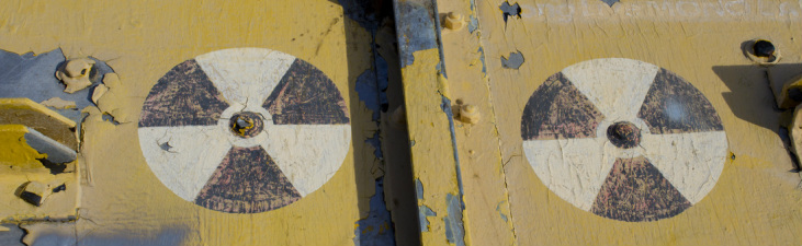
Radiation Warning on Bunker Doors, LA-88 Oat Mountain
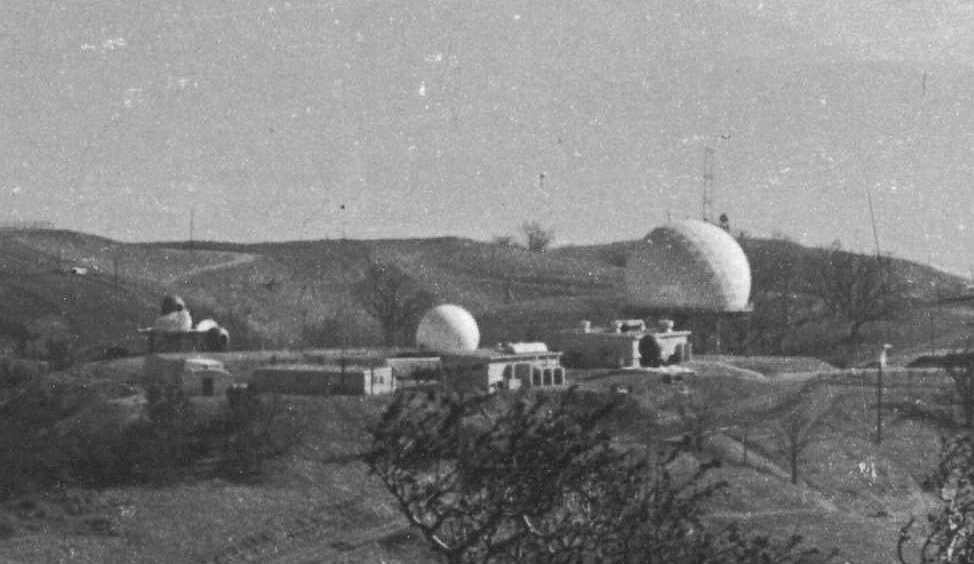 LA-88 Radar Oat Mountain Summit, 1969
 Hiking the wilderness areas surrounding Los Angeles provides intrepid trekers with sweeping mountain vistas, wildlife observation, quiet coves for personal reflection and a general escape from the hustle and bustle of big city living, though you may have to suffer through LA traffic in order to reach such nirvana. On occasion, you may also unexpectedly step into history. This recently occurred for me while making the climb up the wind swept grassy balds of Oat Mountain. About halfway up the trail, the paved Browns Canyon Road, it passes through the remnants of an abandoned military facility constructed during the cold war, but with roots stretching back to World War II and the development of jet aircraft and nuclear weapons.
With the advent of jet fighters and bombers during the second world war, existing gun-based ant-aircraft batteries proved largely ineffective in combatting these new high speed, high altitude aircraft. In 1944, to counter this advance in weaponry, the US Army, in conjunction with Bell Laboratories, developed a line-of-sight anti-aircraft missile system called Project Nike (named after the Greek Goddess of Victory). The project’s goal was to acquire and track an incoming enemy plane should it evade Navy and Air Force resources and then launch and guide a defensive missile to the incoming target. This had never been attempted before and the complex Nike system required 3 separate yet integrated radar systems to achieve that result. Despite its promise, the system was largely considered a last ditch effort to prevent the enemy from delivering its payload as the initial effective range of the Nike Ajax missiles was only about 25 miles, but it marked the first time the US military attempted a strategic air defense of the country based on guided missiles, a safeguard that proactively sought out threats rather than one that simply threw up a barrage of projectiles hoping one would be lucky enough to intercept the target. The missiles later received an upgrade extending the range to about 100 miles and were given the designation Nike Hercules. Though the missiles were capable of carrying warheads of varying size in both conventional and nuclear explosives, the warheads on the US-based Nike missiles were almost entirely nuclear with an explosive rating of 20 Kilotons. By comparison, the bomb dropped over Hiroshima had an estimated explosive yield of only 16 KT. Hiking the serene hills of Oat Mountain today, It is hard to imagine the fear and even paranoia that existed during the Cold War that would justify the detonation of a 20 KT nuclear weapon within 25 miles of Los Angeles, or any of the other 240 sites situated around the United States at the time for that matter, but it was the country's last line of defense for nearly 20 years.
After a successful Nike test in November of 1951, the Army began deploy the system to defend strategic and tactical sites around the country. Sixteen such missile sites were established around Los Angeles to protect the city from Soviet attack beginning in 1956 and remained operational until the early 1970s. The Oat Mountain facility was part of this 'ring of defense' and was designated LA-88. Though LA-88 was closed in 1972, the site remained largely intact until a devastating wildfire swept through the area in 2008, destroying most of the buildings. What remains are mostly large concrete pads that once held barracks, mess halls and administrative offices and a large pad of pavement used as a basketball court. The launch area for the missiles is mostly bare, but the silo doors for the subterranean storage area for the missiles are still in place as is the substructure used to service the missiles.
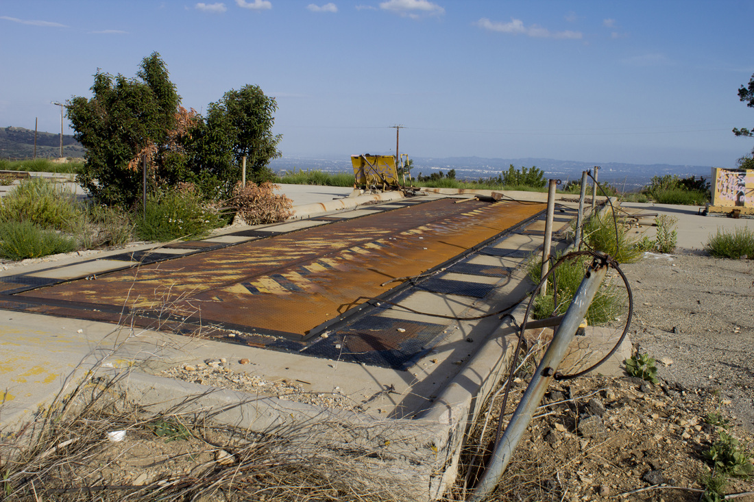
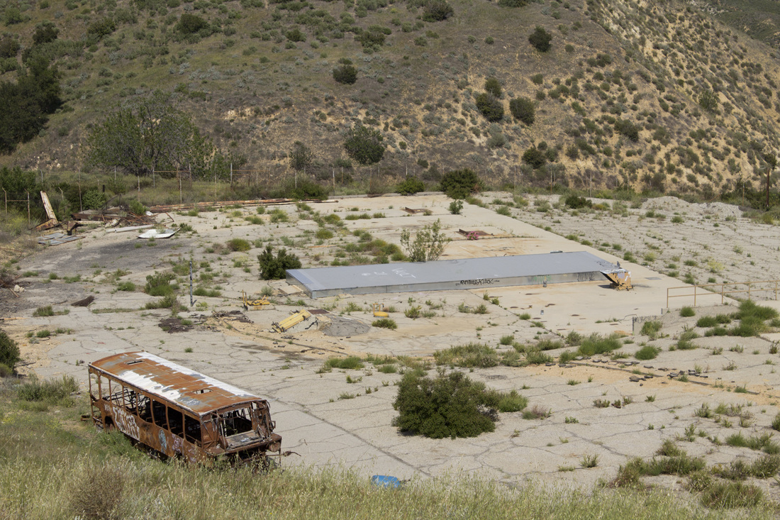 NIke Launch Pad Today
 What makes LA-88 unique is that the trail to the summit of Oat Mountain passes directly through the heart of the former missile complex, providing great views of the facility’s remains. Though it is illegal to trespass on the grounds themselves, the open gates have invited many a hiker and more than a few ‘taggers’ to take a look around. There are a few outbuildings still standing on the southern side of the trail, including the guard shack and missile assembly building. On the north side of the trail, the base flagpole can be found still standing tall in a small garden. In more recent years, the site has been used by the LAPD for SWAT training exercises as evidenced by the shot up buses on the premises. On a recent visit, it was noted that an access panel to the missile storage area beneath the silo doors was open and metal rungs descended into the dark depths below.
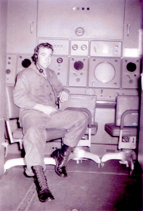
In 2006, Howard Rathbun, who served at LA-88, returned to his former base for a stroll down memory lane. He has written an interesting article with before and after pictures comparing the base’s operational phase with its derelict state that can be found here. Mr. Rathbun was fortunate to visit before the 2008 fire and found all the buildings to be intact at that time. The black and white photos you see here are courtesy of Mr. Rathbun and the Nike Historical Society.
The hike to Oat Mountain’s summit is worth it just for the views and the grassy, rolling hills, but the chance to literally walk through history makes this hike all the more interesting. Another Nike site has been partially preserved in the Santa Monica Mountains at San Vicente Park. Self-guided displays give visitors a look into the Nike Program and how it was used around the country and the still standing radar tower provides impressive views across the Santa Monica Mountains, the San Fernando Valley and the Los Angeles basin.
Learn more about Project Nike here.
 Radar Tracking, 1956 | 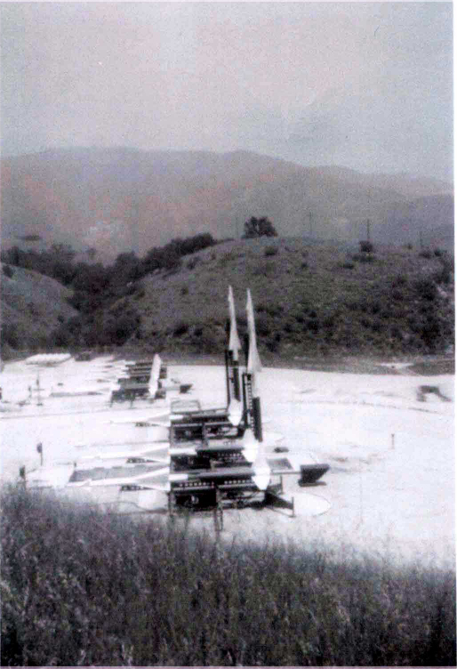 Missiles on the Launch Pad, 1956 |  Base Flagpole Today |
 Silo Doors Today | 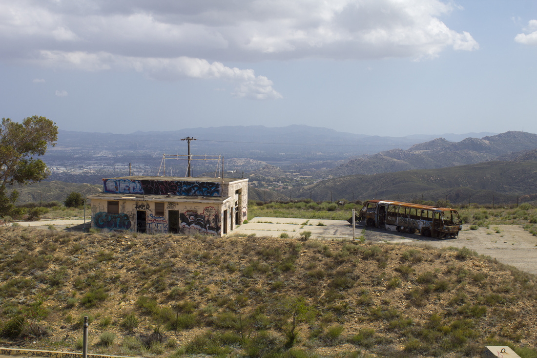 Missile Assembly Building Today |
 RSS Feed
