So step outside and start exploring; you never know what you'll see or who you'll meet.
|
Last week I took a road trip to the Antelope Valley California Poppy Reserve to view the spring superbloom of flowers, but you don't always have to leave the city to explore nature. Sometimes it's as simple as taking a hike in your neighborhood. This morning I set out to discover the the urban wildflowers blossoming on my street and check out the capabilities of a new camera. Granted, the flowering shrubs I found are more cultivated than wild, but it afforded a relaxing opportunity to get out of the house without having to go far. And I met a couple of neighbors, one of which invited me into her backyard to see how she brings the wilderness home.
So step outside and start exploring; you never know what you'll see or who you'll meet.
1 Comment
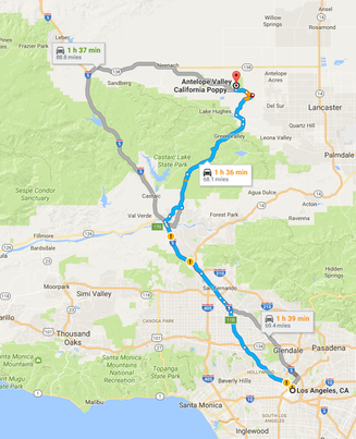
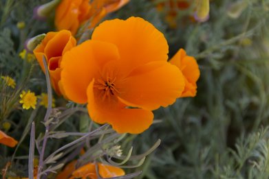 California Poppy California Poppy There’s an old saying that April showers bring May flowers. In California, it’s more like February showers bring March, April and, in some cases, May flowers. That’s if the rains fall, however. With six years of drought on record, the spring wildflower bloom has been somewhat less than spectacular over the past several spring seasons. With our wetter than normal rainy season this year, 2017 has blossomed a bit more dramatically. 6½” of precipitation followed by above average temperatures have created a super bloom in the mountains and high desert plateaus. Flowers have not been this plentiful or colorful in at least a decade, if not longer. This has sent hundreds of thousands of flower peepers scavenging for the latest hotspot of floral activity. Two of the best viewing locations are the Anza-Borrego Desert State Park – two hours northeast of San Diego – and the Antelope Valley California Poppy Reserve – two hours north of Los Angeles. Hoping to catch what some describe as a ‘once in a lifetime’ event, I made the trek through the Green Valley to the Antelope Valley California Poppy Reserve. The reserve is an 1800 acre swath of high desert protected by the state of California in the 1960s as this once ubiquitous plant disappeared from the landscape. The California Poppy was named California’s state flower in 1903, but even then the giant fields of California golden sunlight were being plowed under for farmland or paved over as rural areas became metropolitan. The reserve is now the last spot in California to view a mass bloom of these four-petal, burning-orange flowers. The trip to the reserve is a bit tricky in itself with many twists and turns along a mostly rural highway through the Santa Polena Mountains, but there is a substantial reward in driving through the Green Valley. As the name implies, the valley is incredibly lush and vibrantly green, a result no doubt of this winter’s extensive rainfall. The change in landscape is dramatic as you exit the valley and leave the mountains behind. 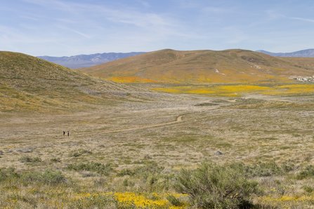 Antelope Valley California Poppy Reserve Antelope Valley California Poppy Reserve The soft, rounded nature of the mountains gives way to hardscrabble, rocky hills with the Antelope Valley Plateau stretching out before you. The panorama vista is streaked with colorful swatches of orange, yellow, purple and green, like an impressionistic watercolor. And the shoulders of the road are ablaze with poppies – thousands of them. There are so many flowers that cars pull over to get up close and personal with the splashy display of nature long before they reach the reserve. It should be noted that these flowers are on private property and stopping to walk among them is technically trespassing, but the locals don’t seem to mind. Once at the reserve, you may have to sit in line for a short time to enter the park. There are so many cars bringing visitors that the park’s staff can get a bit overwhelmed. Weekdays are by far the best time to visit as weekend guests can quickly fill the park to capacity. Once in the park, there is a small visitor center with maps, dioramas, an audio-visual presentation about the ecology of the reserve and a collection of floral paintings created by Jane S. Pinheiro whose conservation efforts spearheaded the formation of the reserve. The park includes 7 miles of dirt trails winding through the fields and to the tops of several small hills for sweeping vistas across the valley and a wheelchair accessible paved section of trail. Visitors are required to stay on the trails and not venture out into the fields to protect the delicate ecology of this last remaining open field of poppies. While the poppies may be the most colorful specimen on display – and the biggest draw – they aren’t the only flowering plant in the reserve. Other botanic perennials include the purple Owl’s Clover, the yellow twisting Fiddleneck, and the lavender Lacy Phacelia. There are nearly two dozen different varieties of wildflowers carpeting the desert along with Joshua Trees, Rabbit Bush and other types of desert plant life.
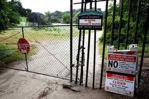 The final access point located on Cloverleaf Drive The final access point located on Cloverleaf Drive The fourth and final access point to the Hillside Wilderness Preserve will finally be open to residents, nearly 16 years after voters adopted two measures to save the hillsides from development. But before access can be granted, the city will need to spend $350,000 to purchase two easements from private property owners to access the trail, which City Council authorized last week, along with allocating an additional $100,000 for capital improvements in the area. “It’s been a community priority for many years to resolve this particular issue and we think this is a sensible way to bring closure to the matter,” City Manager Oliver Chi said. The 1,416 acres of wilderness offers several trails that give hikers and bikers a breathtaking view of Los Angeles and look directly upon Arcadia and Monrovia. The area is home to rare, native species and wildlife and — on a clear day — offers views straight to Santa Catalina Island. Read Courtney Tompkins full article in The Pasadena Star-News HERE.
We are sad to report the death of P-32, the mountain lion that crossed the 101 Freeway earlier this year. He was struck and killed by a motorist as he attempted to cross Interstate 5 near Castaic Lake in the early morning hours of Monday, August 10. P-32 and his sister P-33 made headlines in April when both cats made separate crossings of the 101. Big cats in the Santa Monica Mountains are hemmed in by highways and it makes it difficult for the animals to breed within a healthy gene pool. Because he was a juvenile, it is believed that P-32 was pushing further north to find a mate away from larger, more aggressive males. He had managed to cross not only the 101, but the 23, the 118 and the 126 highways before meeting his fate on the 5 in the Los Padres Mountains. The only other male puma to make it successfully out of the Santa Monica Mountains is P-22 who currently resides in Griffith Park after traversing both the 405 and 101 highways. P-22, however, is not considered a successful transfer by a Santa Monica puma as he is also hemmed in by highways with no female to mate with. For more information on this story, check out this article from KPCC's Sanden Totten.
Take a hike, Los Angeles, by the light of the silvery moon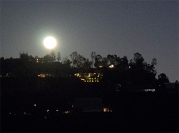 Moon Rise in Franklin Canyon Moon Rise in Franklin Canyon The Greater Metropolitan Los Angeles Area offers a multitude of exciting opportunities to experience nature up close and personal, but for a different perspective on the great outdoors try a nighttime hike in one of our many parks. Even the most familiar of paths can become a whole new adventure as owls screech, bats flit overhead and coyotes yip and howl in the distance. And that ominous sound crunching through the underbrush toward you? The fearsome Los Angeles sabre-toothed mouse! Darkness has a way of heightening your auditory senses, amplifying the most innocuous of sounds into rampaging beasts. But that's part of the fun of hitting a trail at night; you experience the same world in a completely different light, or lack thereof. Being Los Angeles, of course, it's not completely dark. In fact, most of the hikes end with fantastic glittering views of the city's lights stretching from the mountains to the sea. Depending on which event you attend, you may even get a pot luck dinner. Nighttime hikes happen throughout the month, but the most popular are the full moon hikes. These provide some of the most spectacular nightscapes as the moon rises above the San Gabriel Mountains or climbs a canyon ridge on one side while the towers of downtown LA gleam brightly on the other. This month the moon is full on May 4th, but hikes will take place for several days preceding and following this celestial event across the city. Presented below is a selected list of full moon hiking experiences from around the area. April 30 - Great Outdoors Griffith Park LA Full Moon HikeThe Great Outdoors, Southern California's larges gay and lesbian recreational organization kicks things off with a short hike to Mt. Hollywood from the Observatory in Griffith Park. At only 3-miles roundtrip on fairly level fireroad, this is one of the shortest and easiest of the full moon hikes. The hike departs from the Griffith Park Observatory parking lot at the Mt. Hollywood Trail sign. Click here for more information. May 1 - Sierra Club Griffith Park Full Moon Hike and Pot Luck DinnerGriffith Park is one of the most popular spots to view the rising moon and the Angeles Chapter of the Sierra Club leads a hike from the park's carousel to the top of Mt. Hollywood with gorgeous panoramic views of downtown Los Angeles, the San Gabriel Mountains, the Hollywood Sign and the Griffith Park Observatory. Participants should meet at 6:45 in the Upper Merry-Go-Round parking lot for a 7:00 PM departure. The hike will take about 2.5 hours. You should bring, water, flashlight and a snack to share if you wish to participate in the pot luck dinner. Click here for more information May 4 - Stough Canyon Full Moon HikeStough Canyon Nature Center in Burbank offers a combination sunset and full moon trek in the Verdugo Mountains. As the sun sets in the west, the moon rises above Verdugo Peak in the east on this insanely short 3/4 of a mile hike. Views extend across the valley to the Santa Monica Mountains. The nature center often sets up a telescope for viewing the moon and stars close up. Hikers depart from the parking area at 7 PM. For more information, click here. May 4 - Franklin Canyon Full Moon HikeTaking place on the night of the actual full moon, this moderate 4-mile roundtrip hike is centrally located in the mountains between Beverly Hills to the south and Studio City to the north. The views are not as wide as panoramic as in Griffith Park, but the park is much more secluded and far less crowded for a more intimate hiking experience. The group leaves from the Franklin Canyon Ranch parking area at 7 PM. Click here for more information.
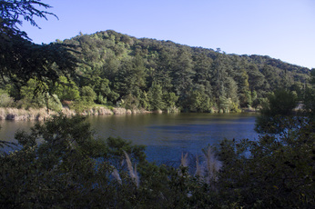 Franklin Lake, Franklin Canyon Park Franklin Lake, Franklin Canyon Park
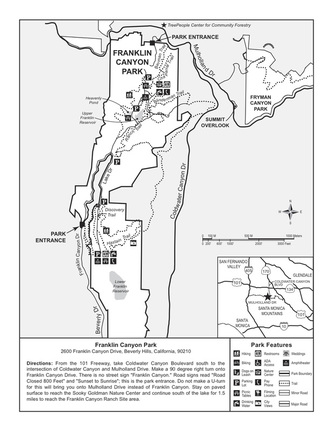
Nestled between Benedict and Coldwater Canyons on 605 acres of land is a hidden oasis of natural beauty: Franklin Canyon Park. This charming and idyllic spot offers a unique sense of seclusion that cannot be found at Tree People/Cold Water Canyon Park just a short distance away, or at the larger Griffith Park, overrun as it is with tourists scrambling to see the Hollywood Sign, hike to the Observatory or ride the Carousel. In fact, wandering the path around Franklin Lake or relaxing on the grassy field of Franklin Canyon Ranch, it is easy to forget that you are mere minutes from the hustle and bustle of Greater Metropolitan Los Angeles. That’s not to say there are no people in the park, it’s just that they seem to move at a slower, more relaxed pace. It also helps that there are fewer of them. This is due in part to the fact the park can be difficult to find if you don’t know where it is. No signage exists on the northern approach, and the southern entrance offers only one sign. As a result, parking is seldom a problem, even on weekends.
Hiking Franklin CanyonFlora and Fauna in the Canyon
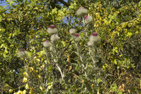
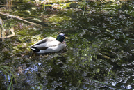
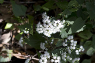
The bottom of the canyon is a rich, dense riparian landscape irrigated by a steady flow of water from Franklin Lake. Several underground springs also add to the watershed, creating a lush landscape year round. As you work your way up the slopes of the canyon, the canopy of oak, walnut and sycamore gives way to the more common chaparral of Southern California. The park is also a birdwatcher’s paradise being home to eagles, horned owls and seven different species of hawks. Franklin Lake and Heavenly Pond are nesting grounds for both Mandarin and Wood Ducks.
William Mulholland and the History of Franklin Canyon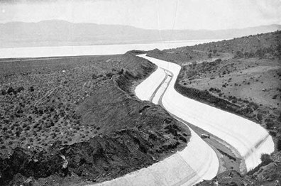 LA Aqueduct from Owens Valley LA Aqueduct from Owens Valley
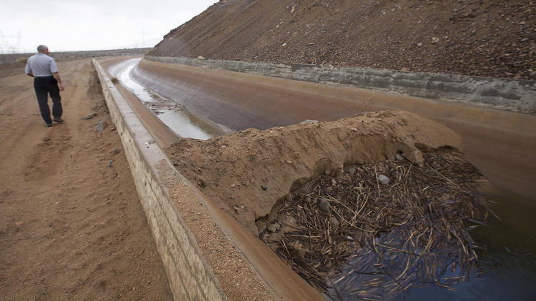
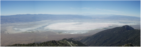
Though not officially designated as parkland until 1981, the origins of the park as we know it today began in 1914. By the turn of the 20th Century, Los Angeles was already a thirsty town and Mayor Fred Eaton sought to quench that thirst by acquiring water rights from the Owens Valley to the east of the city. That these rights may not have been secured through strictly legal means remains a bitter controversy in many parts outside of the metropolitan area t this day. Whether legal or not, the rights were acquired and a 223-mile aqueduct was completed in 1913. The following year William Mulholland and the DWP (Department of Water and Power) began construction on two reservoirs in the upper reaches of the canyon to store and distribute water diverted from the Owens Valley. So much was water was diverted from Owens Valley by Mulholland’s aqueduct that farming became unsustainable by the early 20s and by 1926, just 13 years after the aqueduct opened, Owens Lake was completely dry.
Though the Owens Valley began to blow dust, Franklin Canyon, thanks to a steady supply of water from both the new reservoirs and a series of underground springs, began to bloom setting the stage for the unique ecological environment that exists today. But it wasn’t only Mulholland and the DWP that had a hand in shaping Franklin Canyon. Around the same time as Mulholland was constructing his reservoir, the family of oil magnate Edward L. Doheny purchased the land in the lower canyon for watering and grazing cattle. In 1935, the Doheny’s expanded their presence in the canyon by builing a modest Spanish Adobe style home as a summer retreat. The house still stands today as the Franklin Canyon Ranch and houses park personnel. So well before the US entered WWII, the basic building blocks of today’s park were already in place, and they remained untouched for nearly 40 years until the Sylmar Earthquake of 1971.
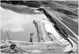 Embankment Failure, Lower Van Norman Dam Embankment Failure, Lower Van Norman Dam
The earthquake, measuring 6.7 on the Richter Scale, occurred at 6 A.M. on February 9 in the northeast corner of the San Fernando Valley. The massive trembler caused extensive damage throughout the valley including the near collapse of Lower Van Norman Dam. As a result, the city and the DWP began a system wide survey of its dams and reservoirs. The Franklin Canyon Reservoirs were deemed at high risk for failure. The lower reservoir was emptied completely and the upper reservoir level was lowered by 15’. A new, modern reservoir and surge dam were constructed below the Doheny Ranch as a replacement. With the upper reservoirs decommissioned and the Doheny Ranch properties slated for sale, the once protected Franklin Canyon was now open for development. Fortunately, Sooky Goldman, a political organizer and conservationist, had other plans. She had a vision for the canyon that included not only preserving the natural state of the canyon, but creating an education center that would enable inner city children to connect with California’s natural resources.
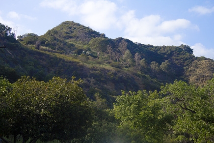 Franklin Canyon from Hastain Trail Franklin Canyon from Hastain Trail
Enlisting the help of Congressman Howard Berman, Ms Goldman convinced the National Park Service to acquire the Doheny holdings as part of the Santa Monica Mountains National Recreation Area and the DWP to donate the upper reservoir property as parkland. The new Franklin Canyon Park, combining both properties, was opened to the public in 1981. Improvements to the property included the construction of the Sooky Goldman Nature Center, the William O. Douglas Outdoor Classroom and the Heavenly Pond. Activities at the park include native arts and crafts, photography and moonlight hikes and natural resources education, all presented free of charge. But man is not the only force working to restructure the park, nature is playing a hand as well. With the lowering of the water level in Franklin Lake (the former upper reservoir), grassy reeds have taken root on the northern perimeter of the lake, creating a marshy area that has become a waterfowl habitat. The reeds are currently encroaching on the southern end of the lake around the dam. As the grasses die off each season, the decaying vegetation is silting up the bottom of the lake. If this cycle continues unabated, the lake will eventually dry up and the ecology of the canyon will change once more, albeit to the more natural state that existed prior to the construction of the reservoir. The decision to be made will be whether to let nature take its course or let man preserve the idyllic oasis he inadvertently created.
For more information on Franklin Canyon Park and its scheduled activities, visit Franklin Canyon Park or Franklin Canyon NPS.
The City of Los Angeles recently opened a section of Mount Hollywood Drive that has been closed to traffic since 1991for a feasibility study on relieving traffic congestion around the Griffith Observatory. Part of the reason for the increase in traffic is due in part by the city trying to relieve traffic congestion (and soothe angry neighbors) in the Beachwood Canyon area. With Los Angeles seeing an uptick in tourism, out-of-towners have flooded the canyon to snap pictures of the fabled Hollywood Sign. City planners means of handling the situation was to simply redirect traffic to the eastern side of Griffith Park and anger homeowners in the Vermont Avenue Ferndell Avenue areas. Vermont Avenue already sees it fair share of traffic with access to both the observatory and the Greek Theatre. Shifting additional traffic there seems little more than a poke in the eye to the neighborhood residents. As a result, the city decided to turn 1.1 miles of the formerly closed Mount Hollywood Drive into a temporary parking lot. This has the double result of inviting more cars to enter the park through Vermont and Ferndell Avenues while reducing the 'wilderness' area of the nation's largest urban wilderness park. While the city is calling this a temporary decision and a feasibility study, outdoor enthusiasts are already rallying to prevent the situation from becoming permanent. A petition is already circulating on change.org asking for a ban on cars and trams on Mount Hollywood Drive. You can find the petition here. Sandi Hemmerlein has also written an informative article on the situation for KCET as shown below.
 The National Park Service Santa Monica Mountains Outdoors Guide, Spring 2015 edition, is now available to download either from Hike-LosAngeles' resource page or directly from the NPS site located here. The guide contains a complete list of hikes, bird watching, cultural events and other educational activities in the Santa Monica Mountains National Recreation Area for the months of April, May and June 2015. Many of these events are free and are sponsored not only by the NPS, but other local organizations such as the Audobon Society or the Sierra Club. Dates, locations, age appropriate guidelines are provide for each listing. For more information on the activities listed, simply contact the agency or persons listed for each event in the guide. So take a hike Los Angeles and discover the wilderness beyond your backyard! |
Hike Los AngelesDedicated to discovering the wilderness beyond the pool area. Archives
April 2017
Categories
All
|




 RSS Feed
